

The Official Factbook of the Republic of Terripin

Terripin, a growing nation still full of new things and excitement. Explore our nation in this guide! We hope you enjoy it!
Geography
OOC:THIS MAP IS OUTDATED, CURRENTLY WORKING ON NEW ONE.
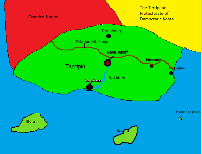
Area: 203,355 sq mi
Comparative Area: About the size of Spain
Bordering Nations: Granden-Nation, Democratic Korea (Protectorate)
Coastal Length: 740 miles
Terrain: Terripin's Terrain is split between North Terripin and South Terripin. The Telarian Range, Terripin's largest mountain range, separates Terripin into North and South. North Terripin is also split into two. Northwest and Northeast. The Northwest is filled with open plains, making it where most of Terripin's agriculture is while the Northeast is heavily forested. South Terripin is mainly flat, with plenty of beaches.
Climate: South Terripin has a Mediterranean climate while the north usually has cold winters and a warm summer. During the summer, Northwestern Terripin can reach up to 100 degrees Fahrenheit.