


The Free City of Zaras
Basic Information
Official name: The Free City of Zaras
Demonym: Zaran
National motto: Freedom and justice for all
National anthem: The Anthem of Zaras
Independence declared: 5 January 1966
Form of government: A hybrid of mayor-council government and parliamentary democracy
Head of state: Governor James D. Lin
Head of government: Mayor Shaheen Muhammad
Official language: English
Recognised regional languages: Any minority language with at least a certain amount of speakers
Official religion: None
Currency: Zaran lira (
Region: Confederation of Democratic Socialists
Total land area: 953 km2
Population: 4.5 million (total metropolitan area)
National codes
National Abbreviation: FCZ
ISO Country Code: ZS (alpha-2), FCZ (alpha-3), 900 (numeric)
ISO Currency Code: ZL
International Calling Code: +91
Top Level Domains: .zs
Sports Code: FCZ
Civilian Naval Craft Code: ZCN
Military Naval Craft Code: ZMN
Sections
1. Introduction
2. History
3. Geography
4. Economy
5. Demographics
5.1. The housing problem
6. Government and political system
6.1. Political system
6.2. Political parties
6.3. Past election results
6.4. Political culture
7. Administrative divisions
8. Law enforcement
9. Foreign affairs
10. Military
11. Media and culture
12. Education
13. Transportation
Introduction
"It was supposed to be all simple. Build a new, custom-made capital for the nation. Solve the constant infighting between the various regions over which gets to be favoured by the government by putting the government in some backwater, tiny peninsula next to the border that had just been recently annexed. Start building and waste ten years getting it done. Surely nothing could go wrong.
One civil war and secession later, we found out just how much could."
One civil war and secession later, we found out just how much could."
- Nirála Kallin, first Governor of Zaras (1966-1981)
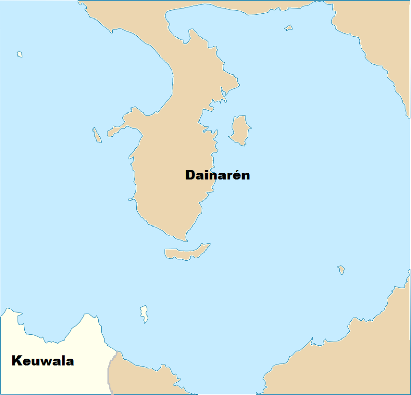
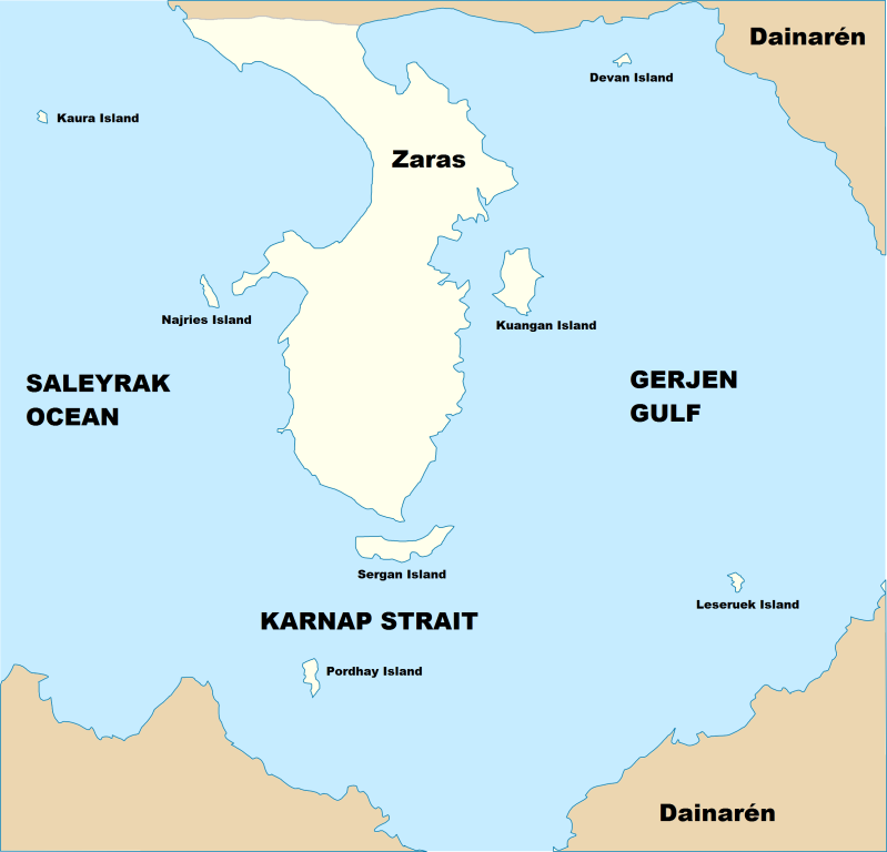
The Free City of Zaras is an independent city-state occupying the Nyari Peninsula and a few nearby islands of varying sizes, affiliated with the Confederation of Democratic Socialists region. Its only borders are with the state of Dainarén in the north, from which it seceded in 1966, the Gerjen Gulf in the east, the Karnap Strait in the south, and the Saleyrak Ocean towards the west (the Principality of Montogranda is located on a peninsula in this direction).
It is a small country of 953 km² (slightly smaller than São Tomé and Príncipe), whose entire territory is legally organised as one metropolitan area. Despite its small land area and medium-sized population, it possesses a reasonably healthy economy, driven primarily by its strategic position as a free port, the service industry, tourism, and the technology industry.
OOC: I'd like to thank Brutland and Norden for having such a good factbook I couldn't help but use it as a model on occasion.
Also, a big big thanks to Steel and Fire for helping me with the map-making!


