NATION

PASSWORD

The Great Big Book of Albertasby...

A place to put national factbooks, embassy exchanges, and other information regarding the nations of the world. [In character]
User avatar
Albertasby
Minister
 
Posts: 2396
Founded: Dec 23, 2010
Ex-Nation

The Great Big Book of Albertasby...

Postby Albertasby » Sun Apr 17, 2011 3:06 am

Foreword, by Ryan Knott, esteemed scholar and professor of Albertasbian culture and history.

Throughout the ages, billions of text have been constructed upon the nations of our world. Yet, not a single one of them as focused upon Albertasby. With this book, put together by various members of Albertasbian nationality, you can see first hand what Albertasby is truly like and also give you all the information you could possibly want... And more! The aim of this book is to provide both you, the reader, and the international community with information all about Albertasby and provide some knowledge towards what we are like as a country.

May you enjoy the reading and we hope that you can pick up some useful information and interesting facts upon your reading. A world of information about this fine country awaits...
Call me Alby // I'm a She

User avatar
Albertasby
Minister
 
Posts: 2396
Founded: Dec 23, 2010
Ex-Nation

Contents Page...

Postby Albertasby » Sun Apr 17, 2011 3:12 am

The Contents Page, by editor Adam Le Vick, editor of Albertasby's number one newspaper, the Daily Albertasbian.

Miscellaneous Pages
- Foreword
-Contents
- Albertasby At A Glance

History of Albertasby
- History Overview
- Prehistoric Albertasby
- Roman Albertasby
- The Border Battles
- The Albertasbian Industrial Revolution

Geography of Albertasby
- Geography Overview
Physical Geography
-Geology
-Mountains, Hills and Volcanoes
- Inland Waters
Last edited by Albertasby on Wed Aug 10, 2011 6:38 am, edited 10 times in total.
Call me Alby // I'm a She

User avatar
Albertasby
Minister
 
Posts: 2396
Founded: Dec 23, 2010
Ex-Nation

Albertasby At A Glance...

Postby Albertasby » Sun Apr 17, 2011 3:58 am

Albertasby At A Glance, by Elizabeth Marcelli, patriotic Albertasbian and chairwoman of 'The Great Albertasby'.

The 'At A Glance' section gives you precise information to allow you to gain a small idea as to what Albertasby is like as a nation. This section will provide you with snappy information, armed with statistics and small snippets of information, giving you information of Albertasby, at a glance.

Image
Figure 1: The Albertasbian Flag
This is the flag of Albertasby and has been flown in the nation for well over seven hundred years. It contains the following symbolisms;
- The wavy borders represent both the vast amount of waters and the mountains.
- The green represents the Earth and the environmental love of the nation.
- The blue represents the sky and the water.
- The white and the doves represent peace.
- The golden colour of the dove represents the importance of the dove in our nation.

Image
Figure 2 : The Albertasbian Coat of Arms
This is the coat of arms that has been used to represent Albertasby for about five hundred years. It features the national animal (the dove), the nation's love of water (represented by the blue) and also symbolises peace (the dove and the white). It was designed by Paul Charleson as a sign of peace and also as a gift.

Official Name:
- The Commonwealth of Albertasby and its Overseas Territories
Common Name:
- Albertasby


Capital (and also largest city):
- Swantana. It has the nickname of 'The City of 1,000 Dreams'


Official Language:
- English
- French
Recognised Regional Languages:
- German


Ethnic Groups:
- 90% Albertasbian
- 4% Albertasbian Overseas Terrioties
- 4% European
- 1.6% Asian
- 0.4% Other


Demonym: Albertasbian for a singular person, Albertasbians for multiple persons.


Government: A monarchy as overall rulers with an elected government to govern country. These are split into two houses, The House of Constituents and The House of Counties. The House of Constituents are representatives of individual towns, cities and villages, The House of Counties are representatives of whole counties. Both houses members are elected. All new laws must be passed by the monarch and at least 51% of both houses.
- Current Monarch: King Adam and Queen Snowflake Levick
- Current Prime Minister : Sheila Buckton (Elected May 2006)
- Current Speaker of the House of Constituents : Edward Buckton (elected, May 2008)
- Current Speaker of The House of Counties: Lillian Levick-Quinn (elected, May 2008)


Area:
- Total : 7, 835 km²
- Water (%) 1.25%


Population:
- 2011 Estimate : 17, 479, 084
- 2009 Census : 16, 898, 975
- Density : 22.3/km²


GDP:
- Total : $3.325 billion
- Per Capita : $190, 227


Currency:
- Swanilat (Φ)
- 100 Microswanilats make up one Swanilat


Time and Date Format:
- Date: dd / mm / yyyy
- Time: 00 : 01 - 23 : 59 (24 Hour Clock)


Drives:
- On the left hand side of the road


ISO 3166 code:
- Alb


Internet TLD:
- .alb

Last edited by Albertasby on Sat Aug 20, 2011 10:31 am, edited 3 times in total.
Call me Alby // I'm a She

User avatar
Albertasby
Minister
 
Posts: 2396
Founded: Dec 23, 2010
Ex-Nation

A Little Introduction...

Postby Albertasby » Sun Apr 17, 2011 4:29 am

A Little Introduction, by Albert DiGaeto, playwright and dramatist, renowned for making Albertasby's theatres popular.

'A Little Introduction' is a section that will ease you into the book about Albertasby. It provides you with some basic information of Albertasby and also gives an overview as to what the country is like.

The Commonwealth of Albertasby and its Overseas Territories (commonly known as Albertasby) is a sovereign state in the north west of 10000 Islands It spans an archipelago of dozens of islands; with four main land masses and various other, smaller islands and inlets. There are no land borders with any other nations as the archipelago is completely surrounded by water.

Albertasby is a constitutional monarchy governed by a parliamentary system, with its seat of government in the capital city of Swantana. Each of the four major islands has developed their own form of parliament, however it can not override laws that have been passed by the collective government in power over Albertasby itself.

All in all, there are thirty six overseas territories that are ruled over by the Albertasbian government and the royal family, however, it seems that the number of these territories shall rise as more and more nations are wanting to become an overseas territory of Albertasby.

Albertasby is a highly developed country with one of the world's highest GDP rates. It prides itself upon being the first industrialised country in the world, having its own industrial revolution before any other country in the world, and was a prominent power in the 18th, 19th and 20th centuries. Albertasby is a recognised nuclear weapons state and is a leader in world affairs. It has a large influence over economy, culture, science and politics in the world and prides itself on having one of the largest empires of the modern world.
Last edited by Albertasby on Fri Jun 03, 2011 12:06 pm, edited 1 time in total.
Call me Alby // I'm a She

User avatar
Albertasby
Minister
 
Posts: 2396
Founded: Dec 23, 2010
Ex-Nation

History Overview...

Postby Albertasby » Sun Apr 17, 2011 6:23 am

History Overview, by Adrianna Whispin, a university lecturer and scholar who wrote the papers on Albertasby's history

The history of Albertasby concerns the study of the past of one of the world's most influential nations. What is now Albertasby, a country within HGH, was first inhabited by Neanderthals, almost 230, 000 years ago. Continuous human habitation dates to around 12, 000 years ago, with the ending of the last ice age.

The country has hundreds of remains from various time periods, such as the; Mesolithic, Neolithic and the Bronze Age, such as Hengley and Avengar. In the Iron Age, Albertasby, like most of HGH, was inhabited by the Celtic peoples; known as the Albertons. In AD 12, the Roman conquest of Albertasby began and the people welcomed them in with open arms. The two sets of people ruled Albertasby jointly, until the collapse of Rome.

After the Romans had left Albertasby, the Celts regained total control of the country and began to venture out into the unknown world. It was from there that the overseas territories began to build up after the Albertons established a trading colony in Frankoise.

During this time period, dozens of battles began to occur as towns and cities wanted to govern themselves and others. This lead to separate kingdoms being established in the country and they battled furiously with each other.

In 1165, King Alexander conquered the nation and united the nation once and for all. Under the rule of Alexander, more and more islands and nations became overseas territories to Albertasby and their empire grew stronger and stronger.

During the Albertasbian Industrial Revolution, Albertasby ruled a worldwide empire that was larger than any other on Earth. To this day, Albertasby has the largest known empire on Earth.
Call me Alby // I'm a She

User avatar
Albertasby
Minister
 
Posts: 2396
Founded: Dec 23, 2010
Ex-Nation

Prehistoric Albertasby...

Postby Albertasby » Sun Apr 17, 2011 8:37 am

Prehistoric Albertasby, by Marie Anne Hardy, an archaeologist and prehistory specialist, being credited with the discovery of the 'Buzzardina Tools'

Prehistoric Albertsaby is the period between the arrival of the first humans in Albertasby and the start of recorded Albertasbian history. The history of Albertasby is conventionally reckoned to begin in AD 12 with the Roman conquest of Albertasby, though some historical information is available from before this. Prehistory is commonly divided chronologically into distinct periods, based on the development of tools from stone to bronze and iron as well as changes in culture and climate, but their boundaries are uncertain, and the changes between them gradual.


The Palaeolithic Era

-
Image
Palaeolithic (Old Stone Age) Albertasby is the period of the earliest known occupation of Albertasby by humans. This huge length of time saw many changes in the environment, encompassing several glacial and interglacial periods that greatly affected human settlement in the region. Providing dating for this distant period of time is difficult and contentious. The inhabitants of the region at this time were bands of hunter-gatherers who roamed northern Europe following herds of animals, or who supported themselves by fishing.

- Lower Palaeolithic (up to 250,000 years ago) There is evidence from bones and flint tools found in coastal deposits near Laithwaiten in Canaria and Mont. Mireaux in Crowa that a species of Homo was present in what is now Albertasby around 700,000 years ago. Archaeologists have found a string of early sites located close to the route of a now lost watercourse named the Mutham River which indicate that it was exploited as the earliest route west into Albertasby.

- Middle Palaeolithic (from around 180,000 to 40,000 years ago) From 180,000 to 60,000 there is no evidence of human occupation in Albertasby. From 60,000 to 40,000, Albertasby was grass land with giant deer and horse, with woolly mammoths, rhino and carnivores. Neanderthal man had arrived in Albertasby by around 40,000 years ago.

- Upper Palaeolithic (around 40,000 – 10,000 years ago)
Image
Evidence of Neanderthal occupation of Albertasby is limited and by 30,000 BC the first signs of modern human (Homo sapiens) activity are known. The most famous example from this period is the burial of the "Blue Man of Ravina" in modern day coastal south Ravenin. A final ice age covered Albertasby between around 70,000 and 10,000 years ago with an extreme cold snap between 22,000 and 13,000 years ago. This may well have driven humans south and out of Albertasby altogether. Sites such as Drac's Cave in Marminta dated at 12,000 BC provide evidence suggesting that humans returned to Albertasby towards the end of this ice age, in a warm period.


-Mesolithic (around 10,000 to 5,500 years ago)
Image
Around 10,000 years ago the ice age finally ended. Temperatures rose, probably to levels similar to those today, and forests expanded further. The warmer climate changed the Arctic environment to one of pine, birch and alder forest; this less open landscape was less conducive to the large herds of reindeer and wild horse that had previously sustained humans. Those animals were replaced in people's diets by pig and less social animals such as elk, red deer, roe deer, wild boar and wild cattle which would have required different hunting techniques. Tools changed to incorporate barbs which could snag the flesh of an animal, making it harder for it to escape alive, thus increasing hunting techniques.

Images used:
-Figure 3. A Man's Skull.
This skull was found in the salt plains of Ranford, in Southern Albertasby. Archaeologists and pathologists both date the skull to the Palaeolithic Era, making it the oldest found human remains in Albertasby. It is currently in the Swantana National Museum.

- Figure 4. The Rivaulx Cave Paintings.
The cave paintings found in Rivaulx date back to the Upper Palaeolithic era of time and are said to be a painting of a typical hunt. These cave paintings are one of only a few remains from the Palaeolithic era and are scarce world wide. The cave is currently a protected area and therefore, the paintings can not be viewed.

- Figure 5. The Remains of a House.
These remains of a house date back to the Mesolithic era and are said to have been a spacious, open plan way of living. This relic is one of the oldest ever records of any man made accommodation and were made of flint and stone. The remains are one of the most visited sites in Albertasby.
Last edited by Albertasby on Mon Apr 18, 2011 12:06 am, edited 1 time in total.
Call me Alby // I'm a She

User avatar
Albertasby
Minister
 
Posts: 2396
Founded: Dec 23, 2010
Ex-Nation

Roman Albertasby...

Postby Albertasby » Sun Apr 17, 2011 3:08 pm

Roman Albertasby, by Brian Lane, historian and Roman expert, specialising in Roman cultures and customs.

Roman Albertasby was the time in which Albertasby was ruled jointly between the Roman Empire and the Alberton Celts, between AD 12 until around 430.

The Romans referred to their territory as Albertannia, naming it after the local Celtic tribes that were governing the country alongside them. Prior to the Roman conquest, Albertasby had next to no contact with the world and so, the Romans bought a lot of developments with them, including;
- Agricultural methods
- Urbanisation, paths and roads
- Industry and manufacturing in workplaces
- Entertainment
- Food and drink
- Manners and customs
- Architecture and new building materials.
The Roman influence can still be seen today in numerous towns and cities throughout Albertasby and their legacy still remains.

The forces of Augustus, in AD 12, were the ones who established a government in Albertasby. Although the intentions were to take the land by force, the Alberton Celtic people welcomed the Romans in and thus, with the help of them, established a joint governement. Various battles in the north occurred for numerous years after the conquest, as the far Northern tribes didn't associate themselves with the Albertons, however they were crushed at the battle of Canaria, in AD 45.
Call me Alby // I'm a She

User avatar
Albertasby
Minister
 
Posts: 2396
Founded: Dec 23, 2010
Ex-Nation

The Border Battles...

Postby Albertasby » Mon Apr 18, 2011 12:08 am

The Border Battles, by Matthew Watson, historian and author, world renown for his text on the battles of Albertasby.

The Border Battles were the battles that began to occur once the Roman Empire had collapsed and Albertasby was totally governed by the Alberton Celtic peoples. The Celtic tribes of the far North and also the South West all claimed that they were not associated with the Albertons and therefore claimed independence.

As resistance to the ruling grew, more and more towns and cities decided to go independent, wanting to govern themselves but also to take control of Albertasby. Whole towns and cities suddenly developed into miniature kingdoms and huge castles a plenty were constructed during this era.

As the years went on, and the battles continued, four main kingdoms established themselves; the Albertons in the East, the Susini Tribes in the West, the Paulo Peoples of the North and the Sharonas in the South. The country was divided into four separate kingdoms.

In 1026, the Albertons defeated the Paulo armies at the battle of Monte Grove, and conquered there kingdom. This led to an alliance being formed between the Paulo Peoples and the Susini Tribes. With this newly formed alliance, several battles ensued, with these results;

- The Battle of Curti was a large victory for the alliance, capturing the towns of Curti North and Curti Brook.
- The Battle of Mandon was a small victory for the Albertons as the seized the town of Mandon.
- The Crooks Cove Conflict was another victory for the Albertons, gaining the towns of Crooks Cove and Granthe.
- Myridon Battle resulted in a dead heat, with both sides retreating at the sight of a black deer, a bad battle omen for the Celtic Peoples.
- The Battle of Groove Hill was a victory for the alliance and secured them the town of Groove but also the strategic range of hills running down part of the country.

This period of Albertasbian history ended in 1165, with the unification of Albertasby.
Call me Alby // I'm a She

User avatar
Albertasby
Minister
 
Posts: 2396
Founded: Dec 23, 2010
Ex-Nation

The Unification of Albertasby...

Postby Albertasby » Mon Apr 18, 2011 6:52 am

The Unification of Albertasby, by Damon Sykes, historian and guest presenter of "History's A Mystery!"

The Unification of Albertasby began in 1165, when the French king, Alexander, conquered Albertasby. The factions fighting against each other aided in his conquest and the battle had been a short but successful one. Although the true unification of Albertasby didn't occur until 1179, the process began by the actual conquest.

Image
When the final Susini tribes of the far west finally fell, Albertasby was once again a united country. However, King Alexander had passed away at this point and never did see his dream for a united Albertasby come true. But it was under General Fitzpatrick, the kings right hand man, that the country really did prosper.

As sailing conditions improved and experience on the islands were high, the general ordered for droves of men to sail out and investigate foreign lands. Whilst doing this, many men chose to say on the foreign lands that were found, but the general didn't mind as most islands agreed to join Albertasby. During his twenty year reign, the Albertasbian empire grew to encompass twenty seven overseas territories.

Upon the death of the general, the peoples of Albertasby banded together and remained as a strong, united unit. The army tactics of the general and the ideologies of Alexander are still prominent in modern day Albertasby.

Images used:
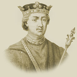
- Figure 6. King Alexander.
This portrait of Alexander is believed to have been painted in 1173, a year before his tragic death. King Alexander was a French king who fled France for a better life. He conquered Albertasby for his own and fell in love with the country, taking it to greatness.
Call me Alby // I'm a She

User avatar
Albertasby
Minister
 
Posts: 2396
Founded: Dec 23, 2010
Ex-Nation

The Albertasbian Industrial Revolution...

Postby Albertasby » Mon Apr 18, 2011 8:58 am

The Albertasbian Industrial Revolution, by Abigail Birtill, inventor, entrepreneur and editor of "Product" Magazine.

The Albertasbian Industrial Revolution is the period of time when industry suddenly rose to fruition, with the aide of steam power. In Albertasby, this began in the early 18th century, almost half a century before the rest of the world and saw advances in manufacturing, technology and labour forces.

Image
As with all countries affected by the revolution, a sudden surge of industry saw mass rural-urban migration and increased urbanisation. Factories became the biggest employers and suddenly, Albertasby was producing enough goods to service the world with manufactured products.


Image
One major downside to the industrial revolution was the sudden increase in pollution. Breathing problems were common and in heavily industrialised cities, buildings began to blacken. As the government began to see the problem, they began to slow down industry and by the early 19th century, almost all of the industry had gone from Albertasby.

Images used:
- Figure 7. The Steam Engine.
The steam engine was a major influence in the industrial revolution and is the main power that fuelled the industry and manufacturing. The use of steam power was used, however the industrial revolution really harnessed the power of steam and it fuelled the world's economy for this time period.

- Figure 8. A Painting of Doberma.
Doberma is a city that was dubbed the "Cottonopolis" of Albertasby as it produced the highest amount of textiles in the country. Its massive factories were one of the worst pollutanting cities in the world, as shown by the amount of chimneys.
Call me Alby // I'm a She

User avatar
Albertasby
Minister
 
Posts: 2396
Founded: Dec 23, 2010
Ex-Nation

Geography Overview...

Postby Albertasby » Mon Apr 18, 2011 12:50 pm

Geography Overview, by Ruby-May Robinson, geographer and chairwoman of the Albertasbian Mapping Association.

The Geography of Albertasby is the study of both physical and human aspects of the land mass that make up the country of Albertasby. The current nation of Albertasby is an archipelago of dozens of islands; with seven larger islands and several more, smaller inlets and islands. The areas of the nation lie between the tropic of Capricorn and the Equator, explaining its varied terrain and lies on the Albertasbian Meridian, its own time zone that is 1 hour ahead of UTC.


Albertasby lies in the Atlantic Ocean and is affected greatly by the winds and currents of the ocean. As Albertasby is an archipelago nation, it doesn't have any land borders with any other countries, however some of the overseas territories do share land borders with other nations.


The total landmass of Albertasby is 7, 835 km², including all of the islands of the archipelago. Alban is the largest of the islands; being 875km² and the smallest island is Manger; being less than 10km².
- Alban is 875km²
- Susini is 783km²
- Destin is 727km²
- Gath is 690km²
- Enge is 576km²
- Roosham is 550km²
- Narm is 529km²
- Isle de Strange is 328km²
- Eli is 312km²
- Bacter is 308km²
- Flux is 299km²
- Happi is 288km²
- Islandia is 264km²
- Julpa is 260km²
- Leo is 238km²
- Opalia is 227km²
- Ronvualx is 214km²
- Zeeta is 210km²
- Wonta is 55km²
- Welka is 53km²
- Emerald Island is 51km²
- Truffalia is 47km²
- Electona is 36km²
- Safro is 31km²
- Pastini is 26km²
- Meteracia is 25km²
- Kalm is 23km²
- Menthe is 20km²
- Heather is 18km²
- Manger is 10km²
Call me Alby // I'm a She

User avatar
Albertasby
Minister
 
Posts: 2396
Founded: Dec 23, 2010
Ex-Nation

Geology...

Postby Albertasby » Wed Apr 20, 2011 4:33 am

Geology, by Damien Rothwell, geologist and vulcanologist and author of "3rd rock from the sun is more than one rock"

The geology of Albertasby is one that is diverse and varied. This has helped to shape Albertasby and has contributed to the wide variety of landscapes and terrains that are found throughout Albertasby.

The oldest rocks in Albertasby are gneisses; dating from at least 2,700 million years ago and found in the far north west of Alban, with a few small outcrops elsewhere. South of the gneisses are a complex mixture of rocks. These are essentially the remains of folded sedimentary rock, deposited over the gneiss, from 1,000 million years ago, with a notable 4 km thick layer of Torridon Sandstone being deposited about 800 million years ago, as well as the debris deposited by an ice sheet 670 million years ago.

Under the majority of the islands of Albertasby are the remains of ancient, extinct volcanoes, with many having small craters on the surface. There are, however, a few dormant volcanoes on the islands, with an active volcano on Safro. These volcanoes have formed many of the islands and inlets that exist today as a part of the country.
Call me Alby // I'm a She

User avatar
Albertasby
Minister
 
Posts: 2396
Founded: Dec 23, 2010
Ex-Nation

Mountains, Hills and Volcanoes...

Postby Albertasby » Mon May 02, 2011 6:16 am

Mountains, Hills and Volcanoes, by Rochelle Naylor-Ihami, vulcanologist and keen Albertasbian rock climber.

Throughout Albertasby, the country is lined by hills and mountains and to the south are a few volcanoes. These all combine to create spectacular valleys, high peaks and even new islands and beaches.

Mountains
Image
The ten tallest mountains all occur on Flux, in the West. The average height on this island is 267 meters above sea level; with the highest mountain being Mount Talerin, at 2, 433 meters above sea level.

Albertasby has two main mountain ranges; the Peekers in the East and the Reachers in the West, so named because the Peekers are often climbed for their views and the Reachers are often climbed for the heights. Although there are more ranges, these are the two major mountain ranges.


Hills
Image
Hills are found all over Albertasby; with most people living within a kilometre of a hill. This has lead to many people using the levelling out hills but their peaks are still obvious and seen. A recent poll found that at least 23% of the population have lived on a hill at some point in their lives.

Throughout the centre of the country, a range of hills known as the Hillians runs down the centre of the central islands, forming a backbone to the country. These are the highest of the hills in the country and the slopes are some of the most fertile land found.


Volcanoes
Image
Electona is the only one of the islands to have volcanoes; having two. Mount Kronoa is the smallest of the two as it is a shield volcano. Although eruptions are common, they are only minor and the lava has never caused injury to anybody. This is the only active volcano in Albertasby.

The other volcano is known as 'The Sleeper' as it has been dormant for over seventy years. An eruption is not expected anytime soon and it is believed that it may have gone extinct. Both volcanoes provide a steady income in tourism.

Although there is a lack of volcanoes now, it is believed that underground volcanoes are still part of Albertasby, this being apparent in certain land swells and also due to the fact that new islands and inlets are forming continually. As for now, the Albertasbian Volcanic Society are funding research into this, to see if there truly are magma pockets below Albertasby.


Images Used
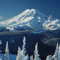
- Figure 9. Mount Talerin.
Mount Talerin is the tallest mountain in Albertasby, standing at 2, 433 meters above sea level. It is found on the island of Flux, as with the other ten tallest mountains of Albertasby. It is a popular ski resort and relies heavily on tourism.

- Figure 10. The Hillians.
The Hillians are the central "backbone" to the country and run down the centre of most of the central islands. They are the largest of the hill ranges in Albertasby and boast spectacular scenery and views; making them popular with both locals and tourists alike.

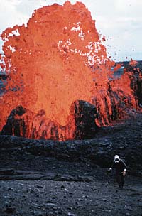
- Figure 11. Mount Kronoa.
Mount Kronoa is the only active volcano in Albertasby and this image shows one of its more violent eruptions. This volcano provides a vast amount of hot springs and heated vents and has been safeguarded in a national park, another honeypot site for tourists.
Last edited by Albertasby on Mon Aug 08, 2011 2:04 pm, edited 3 times in total.
Call me Alby // I'm a She

User avatar
Albertasby
Minister
 
Posts: 2396
Founded: Dec 23, 2010
Ex-Nation

Inland Waters...

Postby Albertasby » Wed Aug 10, 2011 4:30 am

Inland Waters, by Holly Pearson, Limnologist and freshwater swimmer

Albertasby is a nation that is heavily based on the waters of its land. The lakes, streams and rivers have been a key part of life; providing the people with food, medicine, transport, recreation, power, geology studies and drinking water. Lakes and rivers are a crucial part of the lives of people in Albertasby.

The freshwater rivers and lakes provide a home for an abundance of fish, including salmon, catfish, trout, tetras and cichilids. A lot of fishing competitions take place on the rivers and lakes of Albertasby.

The longest river in Albertasby is the River Lumi; being just over 180km long, and is on the island of Destin. The river is famous for its salmon and hosts the annual Albertasbian Fishing Festival, every June for three weeks. The river boasts shimmeringly clean waters and is also used by divers quite often.

The largest lake in Albertasby is Lake Jezioro; being 23 km2, and is on the island of Leo. The lake attracts thousands of people, being located in the extremely popular Laken area of the country. People visit to see the wildlife; boasting thousands of fish and birds. Lake Jezioro is also the deepest lake.
Call me Alby // I'm a She

User avatar
Albertasby
Minister
 
Posts: 2396
Founded: Dec 23, 2010
Ex-Nation

Climate...

Postby Albertasby » Sun Aug 21, 2011 2:27 am

Climate, by Ruby Levett, Meteorologist and Weather Girl

Albertasby is a nation with an extremely varied climate dependant on where you are. As the country as a whole has several different biomes, the climate differs on a regular basis. Overall, the climate is warm-temperate, with rainfall and snow common in autumn and winter months.

To be finished later!
Call me Alby // I'm a She


Advertisement

Remove ads

Return to Factbooks and National Information

Who is online

Users browsing this forum: Sveniland

Advertisement

Remove ads