
Only ICON members who are signed up in the ICON military planning thread may take part in this thread.
This is for OOC planning and sign ups only.
This is for OOC planning and sign ups only.

ICON
International Coalition of Nations
Department of Allied Forces
International Coalition of Nations
Department of Allied Forces
ICON Military Exercises Operation I
Marquesan
Goram
Civia Welephilostopia
Goram
Civia Welephilostopia
Sombreland
Neo-Korea
Darlingtown
Blauveldet-Ryszana
Neo-Korea
Darlingtown
Blauveldet-Ryszana
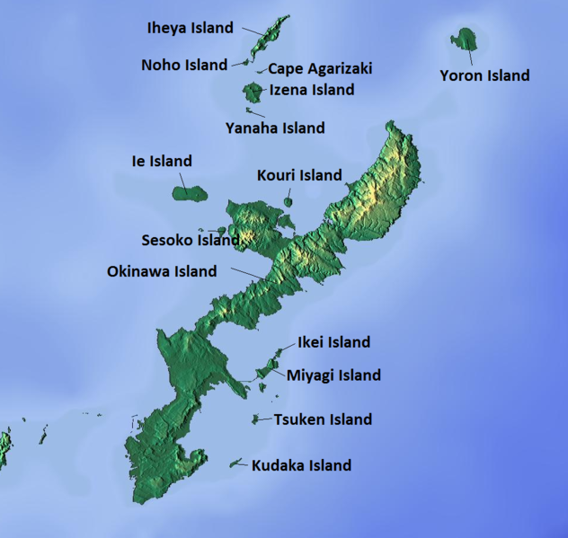
Okinawa Map
The island, known as "Okinawa" for the purposes of the exercise, has a point at its northern point which shall be called "Cape Hedo" for the purposes of the exercise. It has a small population and the population that might get in the way will be temporarily evacuated, and compensated by the nations collectively taking part in the exercise. Some parts of this northern cape consist of rocky cliffs, while other parts are sandy beaches with rocky cliffs flanking.
The island is tropical, and inland there are palm forests. Due to the expressed wishes of the local population, there is to be no intense digging or combat engineering in the area. Instead, it is to be presumed that the exercise, which will be carried out over a 2 day period, did not provide sufficient time for defending troops to dig in.
The exercise is to take place between Hedo, the northernmost town, to Uka to the West and Sosu to the East, approximately 15 km south of the point on either side, and the area in between. Further detailed instructions will be forthcoming.


