The New Cordian Empire wrote:I'd like someone to create a blank political map based off of mine at https://drive.google.com/file/d/1xAwvAwVWL9cDaw2jFxGyYx0g6wkhRW3d/view. Thanks! Feel free to tg me if you need more details.

Advertisement

![]() by The Casuras Archipelago » Sat Aug 22, 2020 3:01 am
by The Casuras Archipelago » Sat Aug 22, 2020 3:01 am
The New Cordian Empire wrote:I'd like someone to create a blank political map based off of mine at https://drive.google.com/file/d/1xAwvAwVWL9cDaw2jFxGyYx0g6wkhRW3d/view. Thanks! Feel free to tg me if you need more details.
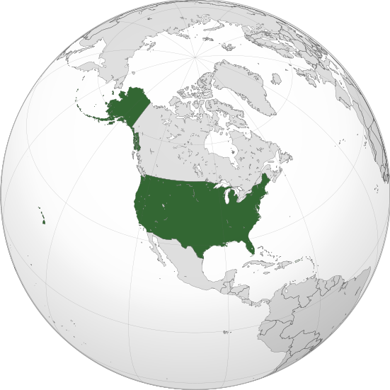
![]() by Cereskia » Sat Aug 22, 2020 3:06 am
by Cereskia » Sat Aug 22, 2020 3:06 am
About my Nation:
Overview | History | Geography | Politics | Military |Economy | International
![]() by The Casuras Archipelago » Sat Aug 22, 2020 3:29 am
by The Casuras Archipelago » Sat Aug 22, 2020 3:29 am
Dukeshand wrote:Howdy:
could I get a map of an island archipelago in the middle area between Greenland, Canada, Iceland, and the UK? It would compromise of 12 states, in no particular order, 4 states on three islands; each the the size of East Malaysia:? The area I would like it is here:
(Image)
The Nation's Name would be Dukeshand (Yours Truly), and the states would be (again in no particular order)
1. Burkenshire
2. Bilbury
3. Victora
4. Aronad
5. Mourn Bay
6. Talisbarry
7. Broome
8. Pictone
9. Bore Sound
10. Worcester
11. Cambridge
12. Gosnold
The map would be purely a political one, with the states, and then may I also have the the nation's place in the world on a global map shown, sort of like a Wikipedia style map, with the IRL nations bordering it (Iceland, Greenland, UK, Canada, US?) thank you Very Much!

![]() by Islands Of Ventro » Sat Aug 22, 2020 9:00 am
by Islands Of Ventro » Sat Aug 22, 2020 9:00 am
Islands Of Ventro wrote:I would love it if someone made a map for my region Benian Empire
I would like it to be a political map
Here are the Empires in order from biggest to smallest(Don’t make them tak up all the room)
New Pontiac
Islands of Ventro
Beani
Practical
Jeff man
Please stop(actual nation)
That is it(from biggest to smallest please)
The Benian empire has a bunch of small landmasses and then a group of islands in the middle of the ocean
The title of the map should be Map of Benain empire and the scale should be 1 inch for 500 miles
Thank you
![]() by The Casuras Archipelago » Sat Aug 22, 2020 10:06 am
by The Casuras Archipelago » Sat Aug 22, 2020 10:06 am
Islands Of Ventro wrote:Islands Of Ventro wrote:I would love it if someone made a map for my region Benian Empire
I would like it to be a political map
Here are the Empires in order from biggest to smallest(Don’t make them tak up all the room)
New Pontiac
Islands of Ventro
Beani
Practical
Jeff man
Please stop(actual nation)
That is it(from biggest to smallest please)
The Benian empire has a bunch of small landmasses and then a group of islands in the middle of the ocean
The title of the map should be Map of Benain empire and the scale should be 1 inch for 500 miles
Thank you
I was wondering if anyone could pick this job
![]() by Slavic States of Cernareka » Sat Aug 22, 2020 11:31 am
by Slavic States of Cernareka » Sat Aug 22, 2020 11:31 am
![]() by Islands Of Ventro » Sat Aug 22, 2020 3:35 pm
by Islands Of Ventro » Sat Aug 22, 2020 3:35 pm

![]() by Almonaster Nuevo » Sat Aug 22, 2020 4:18 pm
by Almonaster Nuevo » Sat Aug 22, 2020 4:18 pm
Slavic States of Cernareka wrote:For my nation's city of Svata Julia, please could someone modify the street layout so it looks less grid-layout like here
and more like this.
Road numbers are A491, A5766 and A622.
Street names should be:
- St. Julia Road (Silnice Svata Julia)
- Blackwood Street (Silnice Cernelesy)
- Ship Street (Poulicni Lod)
- Italian Street (Ulice Italska)
Czech translations provided.
I leave it to you interpret it and add other names as needed.
![]() by The New Cordian Empire » Sat Aug 22, 2020 5:10 pm
by The New Cordian Empire » Sat Aug 22, 2020 5:10 pm
The Casuras Archipelago wrote:The New Cordian Empire wrote:I'd like someone to create a blank political map based off of mine at https://drive.google.com/file/d/1xAwvAwVWL9cDaw2jFxGyYx0g6wkhRW3d/view. Thanks! Feel free to tg me if you need more details.
![]() by Innovationist Eurasia » Sat Aug 22, 2020 5:40 pm
by Innovationist Eurasia » Sat Aug 22, 2020 5:40 pm
::THE FEDERAL INNOVATIONIST STATE OF EURASIA.::
::A REVOLT AGAINST TRADITION, A REVOLUTION OF PROGRESS.::
::If it is Human Nature to act foolishly, then we shall change Human Nature itself.::
![]() by Islands Of Ventro » Sat Aug 22, 2020 6:22 pm
by Islands Of Ventro » Sat Aug 22, 2020 6:22 pm
![]() by New Lindale » Mon Aug 24, 2020 4:34 pm
by New Lindale » Mon Aug 24, 2020 4:34 pm
![]() by Cor Cada » Tue Aug 25, 2020 4:14 am
by Cor Cada » Tue Aug 25, 2020 4:14 am
News from Cor Cada | A. Millarai elected President in a historic first | Government promises to strengthen ties with India
![]() by New Lindale » Tue Aug 25, 2020 6:55 pm
by New Lindale » Tue Aug 25, 2020 6:55 pm
![]() by Cor Cada » Tue Aug 25, 2020 7:53 pm
by Cor Cada » Tue Aug 25, 2020 7:53 pm
New Lindale wrote:Cor Cada wrote:I use mapchart.net.
Would you happen to know of a similar website that has Antartica?
News from Cor Cada | A. Millarai elected President in a historic first | Government promises to strengthen ties with India
![]() by Imperial League » Sat Aug 29, 2020 11:28 pm
by Imperial League » Sat Aug 29, 2020 11:28 pm
![]() by Imperial League » Sun Aug 30, 2020 2:19 pm
by Imperial League » Sun Aug 30, 2020 2:19 pm
![]() by Almonaster Nuevo » Mon Aug 31, 2020 12:26 am
by Almonaster Nuevo » Mon Aug 31, 2020 12:26 am
![]() by Persum » Fri Sep 18, 2020 4:03 pm
by Persum » Fri Sep 18, 2020 4:03 pm
![]() by Almonaster Nuevo » Fri Sep 18, 2020 5:12 pm
by Almonaster Nuevo » Fri Sep 18, 2020 5:12 pm
Persum wrote:Could someone make me the map of a European city. Just general raa as neon streets and area. I need this as I’m a city state.
Return to Factbooks and National Information
Users browsing this forum: Kannap


