NATION

PASSWORD

Map Request Thread

A place to put national factbooks, embassy exchanges, and other information regarding the nations of the world. [In character]

Advertisement

Remove ads

User avatar
Branislau
Political Columnist
 
Posts: 5
Founded: Nov 06, 2018
Ex-Nation

Postby Branislau » Thu Jan 10, 2019 3:02 pm

Branislau wrote:Hello, could someone please give a close-up image of Central Europe, with Görlitz coloured in #0373A1? Thanks.

Bump
Grand Duchy of BranislauGott rette Branislau!

The Grand Duchy of Branislau is a small, landlocked semi-constitutional monarchy in Central Europe. It is situated on the Spree river, surrounded by the German state of Saxony. It is majority Slavic, and is ruled by the von Branislau family. The Grand Duchess is Katerina II.


User avatar
Christian Murania
Political Columnist
 
Posts: 2
Founded: Jan 18, 2019
Ex-Nation

Good mapping programs?

Postby Christian Murania » Fri Jan 18, 2019 9:38 pm

Hi, I'm looking for a good mapping program. I'm creating a fictitious continent during the modern times and I was just wondering if there was a good way of making it in a map.

Cheers,
Murania
Not a (Radical) Christian, based off the NS cliche thread

User avatar
Ithalian Empire
Senator
 
Posts: 3795
Founded: Jan 19, 2015
Inoffensive Centrist Democracy

Postby Ithalian Empire » Fri Jan 18, 2019 9:41 pm

Christian Murania wrote:Hi, I'm looking for a good mapping program. I'm creating a fictitious continent during the modern times and I was just wondering if there was a good way of making it in a map.

Cheers,
Murania


This is a pretty good mapping program.
Eat ,Drink, and be mary, for tomorrow we die.
PRAISE THE FOUNDERS

The poster licks five public door handles a day to compare there taste.

User avatar
Forlania
Spokesperson
 
Posts: 118
Founded: Feb 13, 2013
Ex-Nation

Postby Forlania » Thu Jan 24, 2019 4:14 am

Hey there, can someone make me a map that shows my nation in it's respective location on planet earth?

Essentially, can you use the typical wikipedia style map, (using the national map I have in my respective factbook as a guide for the shape of the Forlanian Islands) and place it in the Eastern Pacific Ocean on a map that is otherwise identical to the real world (centered primarily around Forlania but showing the majority of South America if possible).

The Forlanian Islands are approximately the same size as New Zealand, and in my geography factbook I provide additional information on the geographical location of the Forlanic Archipelago relative to real world nations.

Hopefully this isn't too complex or convoluted of a request!
Thanks.
Economic Left/Right: -4.0
Social Libertarian/Authoritarian: -3.38


Centauri Central News: Comet SX389 is expected to make a pass near the binary system on Tuesday. Officials recommend tourists stay out of the immediate area & recommend checking the FASA website for safe viewing coordinates.

User avatar
Spearos
Bureaucrat
 
Posts: 51
Founded: Sep 05, 2018
Ex-Nation

Postby Spearos » Thu Feb 07, 2019 6:29 pm

Hi, can I please have a general map made of my nation?

Here is my map.

https://cdn.discordapp.com/attachments/ ... 920_92.jpg


Note: Just make it plain green (for the land) against a blue background (the ocean)
Last edited by Spearos on Fri Feb 08, 2019 12:39 am, edited 1 time in total.

User avatar
Phillipa
Political Columnist
 
Posts: 5
Founded: Feb 08, 2019
Ex-Nation

Postby Phillipa » Fri Feb 08, 2019 3:04 pm

Need someone to color in France, Germany and Switzerland green, and remove the borders.
Last edited by Phillipa on Fri Feb 08, 2019 3:04 pm, edited 1 time in total.

User avatar
North German Realm
Senator
 
Posts: 4494
Founded: Jan 27, 2019
Ex-Nation

Postby North German Realm » Sun Feb 10, 2019 9:56 am

Hello, and sorry to bother you guys, but I needed a favor. Please use this template map but make it look like this map. (The colors don't necessarily matter, though I'd appreciate it if the second map's color scheme (for the countries) were to be followed). Furthermore, I need the inner borders (as in, borders that divide the provinces, etc.) to be gotten rid of.
I realize this might be a lot of busywork, so thanks in advance!
-----------------
-----------------
-----------------
North German Confederation
NationStates Flag Bracket II - 6th place!

Norddeutscher Bund
Homepage || Overview | Sovereign | Chancellor | Military | Legislature || The World
5 Nov, 2020
Die Morgenpost: "We will reconsider our relationship with Poland" Reichskanzler Lagenmauer says after Polish president protested North German ultimatum that made them restore reproductive freedom. | European Society votes not to persecute Hungary for atrocities committed against Serbs, "Giving a rogue state leave to commit genocide as it sees fit." North German delegate bemoans. | Negotiations still underway in Rome, delegates arguing over the extent of indemnities Turkey might be made to pay, lawful status of Turkish collaborators during occupation of Azerbaijan, Cyprus, Syria.

User avatar
Almonaster Nuevo
Negotiator
 
Posts: 6846
Founded: Mar 11, 2007
Civil Rights Lovefest

Postby Almonaster Nuevo » Sun Feb 10, 2019 3:20 pm

North German Realm wrote:Hello, and sorry to bother you guys, but I needed a favor. Please use this template map but make it look like this map. (The colors don't necessarily matter, though I'd appreciate it if the second map's color scheme (for the countries) were to be followed). Furthermore, I need the inner borders (as in, borders that divide the provinces, etc.) to be gotten rid of.
I realize this might be a lot of busywork, so thanks in advance!


This is as much as I'm prepared to do.
https://imgur.com/vy0l4xj
Christian Democrats wrote:Would you mind explaining what's funny? I'm not seeing any humor.
The Blaatschapen wrote:I'll still graze the forums with my presence
Please do not TG me about graphics requests. That's what the threads are there for.

User avatar
Basilia
Bureaucrat
 
Posts: 44
Founded: Jun 07, 2018
Ex-Nation

Postby Basilia » Mon Feb 18, 2019 9:32 am

Apologies in advance but I'm giving a lot of reference maps so you guys don't have to go and look up features. It's a bit complicated so I'm gonna try to be as detailed as possible.


Style: Before I go into detail, the "style reference" (above) is essentially the style in which I want the map to look (political, plain colored, and focusing solely on the one nation). I WOULD like it divided into districts/counties (as the style reference is), however I don't really have a preference as to how they look like, so feel free to vary them in number, size, and shape as you see fit (I'd prefer not too many long straight lines though)

The outline: Basilia (my nation), occupies the general region of the US states of Georgia, North Carolina, South Carolina, and Virginia, along with Nassau and Bermuda, and most of Florida and Maryland. For the outline, follow the Chattahoochee River (in the river map) from where it meets the ocean until it seems to leave Georgia, roughly connect the border to Tennessee River, then follow the Appalachian Mountains (on the mountain map) on their western side all the way up to where they meet the Susquehanna River, and cut off the border on where it meets the ocean (don't include that weird spit of land that Maryland and Delaware share).

City Map: (use the state map and river maps for reference) For cities just place a plain old dot wherever they are. "Porto Rocco" is on the southern Florida Coast (somewhere near Miami if you're familiar). "Tebas" is in north Georgia on the Chattahoochee. "Javillo" is somewhere in the middle of of North Carolina somewhere. "Cid" is on the northern coast of Virginia. "Onegana" is the capital and is somewhere on the coast between Georgia and South Carolina, and if you could mark it with a star instead of a dot, I'd much appreciate it.

IN CONCLUSION: I am very very very sorry for the long drawn out request but I'd be overjoyed if some took it on. I know my wording's a bit vague but I'm in no way looking for perfection and I'd appreciate any attempt. Please feel free to message me if you have any questions about specifics. Thank you again so much.
Last edited by Basilia on Mon Feb 18, 2019 10:43 am, edited 1 time in total.

User avatar
Deims Kir
Lobbyist
 
Posts: 14
Founded: Nov 28, 2018
Left-Leaning College State

Postby Deims Kir » Tue Feb 19, 2019 12:33 pm

Can I get someone to colour Switzerland, Austria, Liechtenstein, and Tyrol region of Italy and remove the borders?
Proud Lands End Member, Cards Player and More

User avatar
Anglomir
Envoy
 
Posts: 241
Founded: Aug 23, 2018
Ex-Nation

Postby Anglomir » Fri Mar 08, 2019 9:12 pm

Hello! I have just spent hours on Gimp and failed miserably...

I am territory 58 on this map here and I am trying to make a states map. My first attempt is this. I am reasonably happy with this, except for the surrounding territories. I would like them to be replaced with realistic looking terrain texture, and their numbers removed. I.e., replace the blue with satellite imagery of oceans, get rid of the borders and replace the bright coloured land with satellite imagery of land (with the exception of the multicoloured area with no numbers - where territory 58 used to be. Thats my state map). I don't know how to, but I'd suggest erasing the colours and then placing a layer underneath containing such texture on photoshop.

Please feel free to clarify; I wanna make this as easy as possible.

EDIT:
Know what, alternatively just make all the other territories gray and merged into one with no numbers. That could be easier. Whatever one works for you :D
Last edited by Anglomir on Fri Mar 08, 2019 9:29 pm, edited 1 time in total.
OBERKONIGREICH OF ANGLOMIR |ᛏᚺᛖ ᚴᛁᚾᚷᛞᛟᛗ ᛟᚠ ᚨᛚᛗᛟᚾᚷᛁᚱ | Portal (Home) | National Anthem
Zitravgrad wrote:"In every man, there is an animal that wishes to dominate. But in Anglomir, we are already the dominating race."

The English Regions wrote:Nationalistic and overly serious, whose idea of fun is having a beer whilst making jokes about foreigners.

Convallaria wrote:Paternalistic Conservatism with elements of theological dominionism.

Painisia wrote:Neo-fascist monarchy

Tondo Federation wrote:Germano-Nordic Vikings who drink a lot of beer and work for 40 hours a day

User avatar
Almonaster Nuevo
Negotiator
 
Posts: 6846
Founded: Mar 11, 2007
Civil Rights Lovefest

Postby Almonaster Nuevo » Sat Mar 09, 2019 7:41 am

Anglomir wrote:Hello! I have just spent hours on Gimp and failed miserably...

I am territory 58 on this map here and I am trying to make a states map. My first attempt is this. I am reasonably happy with this, except for the surrounding territories. I would like them to be replaced with realistic looking terrain texture, and their numbers removed. I.e., replace the blue with satellite imagery of oceans, get rid of the borders and replace the bright coloured land with satellite imagery of land (with the exception of the multicoloured area with no numbers - where territory 58 used to be. Thats my state map). I don't know how to, but I'd suggest erasing the colours and then placing a layer underneath containing such texture on photoshop.

Please feel free to clarify; I wanna make this as easy as possible.

EDIT:
Know what, alternatively just make all the other territories gray and merged into one with no numbers. That could be easier. Whatever one works for you :D


Here's what I've got for you.
Image


Good on you for having a go with the GIMP. Keep at it - it takes a while to learn but it's a a good tool.
Last edited by Almonaster Nuevo on Sat Mar 09, 2019 7:42 am, edited 1 time in total.
Christian Democrats wrote:Would you mind explaining what's funny? I'm not seeing any humor.
The Blaatschapen wrote:I'll still graze the forums with my presence
Please do not TG me about graphics requests. That's what the threads are there for.

User avatar
Anglomir
Envoy
 
Posts: 241
Founded: Aug 23, 2018
Ex-Nation

Postby Anglomir » Sat Mar 09, 2019 9:11 pm

Almonaster Nuevo wrote:
Anglomir wrote:Hello! I have just spent hours on Gimp and failed miserably...

I am territory 58 on this map here and I am trying to make a states map. My first attempt is this. I am reasonably happy with this, except for the surrounding territories. I would like them to be replaced with realistic looking terrain texture, and their numbers removed. I.e., replace the blue with satellite imagery of oceans, get rid of the borders and replace the bright coloured land with satellite imagery of land (with the exception of the multicoloured area with no numbers - where territory 58 used to be. Thats my state map). I don't know how to, but I'd suggest erasing the colours and then placing a layer underneath containing such texture on photoshop.

Please feel free to clarify; I wanna make this as easy as possible.

EDIT:
Know what, alternatively just make all the other territories gray and merged into one with no numbers. That could be easier. Whatever one works for you :D


Here's what I've got for you.
Image


Good on you for having a go with the GIMP. Keep at it - it takes a while to learn but it's a a good tool.

Thanks so much mate!
Last edited by Anglomir on Tue Mar 12, 2019 5:12 am, edited 1 time in total.
OBERKONIGREICH OF ANGLOMIR |ᛏᚺᛖ ᚴᛁᚾᚷᛞᛟᛗ ᛟᚠ ᚨᛚᛗᛟᚾᚷᛁᚱ | Portal (Home) | National Anthem
Zitravgrad wrote:"In every man, there is an animal that wishes to dominate. But in Anglomir, we are already the dominating race."

The English Regions wrote:Nationalistic and overly serious, whose idea of fun is having a beer whilst making jokes about foreigners.

Convallaria wrote:Paternalistic Conservatism with elements of theological dominionism.

Painisia wrote:Neo-fascist monarchy

Tondo Federation wrote:Germano-Nordic Vikings who drink a lot of beer and work for 40 hours a day

User avatar
Third Asopia
Chargé d'Affaires
 
Posts: 446
Founded: Aug 06, 2016
Ex-Nation

Postby Third Asopia » Sat Mar 09, 2019 9:15 pm

Could someone and someone make me a map?
First, the territory has to be in cyan.
Second, I would like Alaska, British Columbia, Yukon Territory, Washington, Oregon, Idaho and Kamchatka. Yeah that sounds long, but.
Presenting my signature signature!
Procrastination... is the art of knowing you have a job to do but know there's like a year till it's due. It's elemental for the Asopin soul to survive in such a slow-paced world.
Bored of having to see Juventus winning the Schudetto too many times? Can wait to see that match where Ronaldo didn’t shoot at all? Tired of seeing Napoli fight for first place when there’s no point? Oh boy, you’ve found a new friend.

I got Theo Theodoridis as my flag model. Showing my love for Greece!

User avatar
Ryssia
Lobbyist
 
Posts: 12
Founded: Oct 20, 2018
Ex-Nation

Postby Ryssia » Sun Mar 10, 2019 8:47 am

Hello,

I’d like to request a map of my nation. It is located on this map, containing the entirety of the land between the mountain ranges north of the red lines. I’d like multiple rivers to be drawn on the map, with a star by one of the rivers, somewhat centred on the map. I’d like the star labelled "Tašahar", the capital city. If possible, I’d like a version 300 pixels wide along with the one created by yourself.

Thank you for your time.
Grand Republic of RyssiaDuty and Honour

An MT nation of conservative and moralistic Tataresque Eurasians ruled by an oligarchic stratocracy, empowered by an apathetic populace.

> Overview | Anthem | Leader <

User avatar
Beroya
Secretary
 
Posts: 37
Founded: Dec 17, 2017
Ex-Nation

Postby Beroya » Tue Mar 12, 2019 8:31 pm

I don't know if I'm late or whatever, but I'd like to make a request.

Essentially, Russia except with all it's pre-collapse borders, Finland, and Canada and Alaska. Colored in royal purple, hope this isn't too much to ask, thank you!

User avatar
New Sukberia
Envoy
 
Posts: 260
Founded: Sep 18, 2018
Inoffensive Centrist Democracy

Map Request

Postby New Sukberia » Fri Mar 15, 2019 9:03 am

Hello, i'm not sure this is the right place for it, but i've made a map, and it's really not good.

So i was wondering if someone could make a map like this one, but better, with actual borders and colors and what not.

Thanks!

Image

The part in red are the Sukberian territories, the nothern territories in lines are the claimed lands.

The Yellow are Caesar's Legion, a madman who wants to become the Sukberian Emperor, and claims the city of Old Walinianka, Walinianka.

Thanks, and if i'm in the wrong here, please tell me where i can move this thread
Professionnal bombass bombillier. Former legionnaire 34-0

User avatar
New Sukberia
Envoy
 
Posts: 260
Founded: Sep 18, 2018
Inoffensive Centrist Democracy

Postby New Sukberia » Fri Mar 15, 2019 9:48 am

Anyone? Please?
Professionnal bombass bombillier. Former legionnaire 34-0

User avatar
The Grand Duchy Of Nova Capile
Senator
 
Posts: 4689
Founded: Jul 12, 2015
Iron Fist Consumerists

Postby The Grand Duchy Of Nova Capile » Fri Mar 15, 2019 12:11 pm

{ TAG }

Hey, not at home right now. I might be able to make a map like this for you, depending on time constraints. I will warn you that it won't be exactly like that one (I'll try to make it as close as I can, but I'd be working from sight). Also, it would be a political map instead of a physical map (so no terrain differentiation).

When I get home tonight I'll post a few maps that I've made. Then you can see if you want me to make one for you like them.
Capilean News (Updated 16 November)
Where is the horse gone? Where the warrior?
Where is the treasure-giver? Where are the seats at the feast?
Where are the revels in the hall?
Alas for the bright cup! Alas for the mailed warrior!
Alas for the splendour of the prince!
How that time has passed away, dark under the cover of night, as if it never were.

The Wanderer

User avatar
New Sukberia
Envoy
 
Posts: 260
Founded: Sep 18, 2018
Inoffensive Centrist Democracy

Postby New Sukberia » Fri Mar 15, 2019 12:47 pm

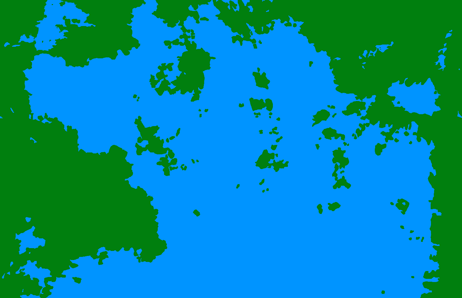
The Grand Duchy Of Nova Capile wrote:{ TAG }

Hey, not at home right now. I might be able to make a map like this for you, depending on time constraints. I will warn you that it won't be exactly like that one (I'll try to make it as close as I can, but I'd be working from sight). Also, it would be a political map instead of a physical map (so no terrain differentiation).

When I get home tonight I'll post a few maps that I've made. Then you can see if you want me to make one for you like them.


Thanks alot man! And no worries about the terrain, i just took what i could. Thanks.
Professionnal bombass bombillier. Former legionnaire 34-0

User avatar
Five Nations
Attaché
 
Posts: 75
Founded: Oct 05, 2018
Ex-Nation

Postby Five Nations » Fri Mar 15, 2019 1:18 pm

Image


All of this land is for PCoFN.
Current date: 3rd of July 2981.
News: Bulgarians became the second biggest ethnic group in the People's Commonwealth of The Five Nations and overtook the Koreans.
True policies of my state. I don't use NS Policies.
Radio Kepler 22-b

User avatar
The Grand Duchy Of Nova Capile
Senator
 
Posts: 4689
Founded: Jul 12, 2015
Iron Fist Consumerists

Postby The Grand Duchy Of Nova Capile » Fri Mar 15, 2019 9:01 pm

New Sukberia wrote:
Thanks alot man! And no worries about the terrain, i just took what i could. Thanks.

Here are two maps that I have made from scratch in the past:

Image
Image

Two questions:
Would you rather it look like the first or second image?
Would you like me to leave it blank for you to label or to label according to your original map?

I'll start working on it tonight, but if I don't finish I won't be able to work on it again until Sunday.
Capilean News (Updated 16 November)
Where is the horse gone? Where the warrior?
Where is the treasure-giver? Where are the seats at the feast?
Where are the revels in the hall?
Alas for the bright cup! Alas for the mailed warrior!
Alas for the splendour of the prince!
How that time has passed away, dark under the cover of night, as if it never were.

The Wanderer

User avatar
New Sukberia
Envoy
 
Posts: 260
Founded: Sep 18, 2018
Inoffensive Centrist Democracy

Postby New Sukberia » Fri Mar 15, 2019 10:55 pm

The Grand Duchy Of Nova Capile wrote:
New Sukberia wrote:
Thanks alot man! And no worries about the terrain, i just took what i could. Thanks.

Here are two maps that I have made from scratch in the past:

Image
Image

Two questions:
Would you rather it look like the first or second image?
Would you like me to leave it blank for you to label or to label according to your original map?

I'll start working on it tonight, but if I don't finish I won't be able to work on it again until Sunday.


They look Great! But i like the second image better, thanks again! Also, i think it's better if You label it, i might Just fuck it up
Last edited by New Sukberia on Sun Mar 17, 2019 3:07 pm, edited 1 time in total.
Professionnal bombass bombillier. Former legionnaire 34-0

User avatar
The Grand Duchy Of Nova Capile
Senator
 
Posts: 4689
Founded: Jul 12, 2015
Iron Fist Consumerists

Postby The Grand Duchy Of Nova Capile » Sun Mar 17, 2019 4:51 pm

Here's the map. Recreated it as closely as I could from the original.
Capilean News (Updated 16 November)
Where is the horse gone? Where the warrior?
Where is the treasure-giver? Where are the seats at the feast?
Where are the revels in the hall?
Alas for the bright cup! Alas for the mailed warrior!
Alas for the splendour of the prince!
How that time has passed away, dark under the cover of night, as if it never were.

The Wanderer

User avatar
Beroya
Secretary
 
Posts: 37
Founded: Dec 17, 2017
Ex-Nation

Postby Beroya » Tue Mar 19, 2019 4:45 pm

The Grand Duchy Of Nova Capile wrote:Here's the map. Recreated it as closely as I could from the original.


May I have a map as well?

PreviousNext

Advertisement

Remove ads

Return to Factbooks and National Information

Who is online

Users browsing this forum: Jucheland, Lehpuhrta, Majestic-12 [Bot], Republics of the Solar Union

Advertisement

Remove ads