Advertisement
by Antwhen » Wed Oct 19, 2016 3:29 pm
by Almonaster Nuevo » Fri Oct 21, 2016 11:03 am
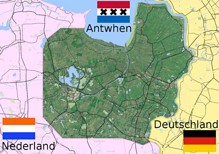
Antwhen wrote:http://imgur.com/dHBYGNe
Can someone please make a really vivid political map of my nation? It's about where the shapes are on my rough draft, but it's all subject to change. I can talk to you more through telegrams if you need clarification or to work out the map. Thank you!
by Karjamaa » Fri Oct 21, 2016 1:15 pm
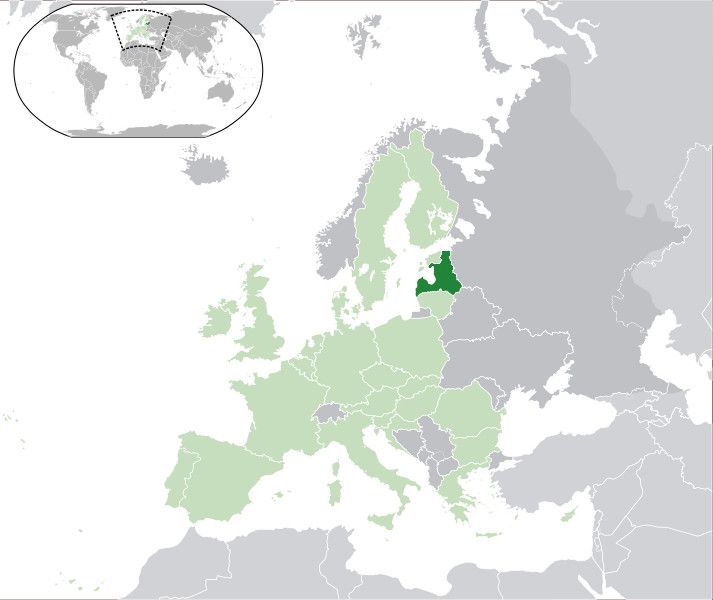
News: Navy to perform large naval exercise in the Baltic Sea - Defence Minister signs anti-agression pact with Russia - 5 skyscrapers planned to be built in central Juurista - Drug runners caught at the Russian border - 12 citizens dead in train crash in Jurmala
Karjamaa Is A Nation Located Roughly In Estonia And Latvia, And Have A Strong Military Tradition.We Do NOT Use NS Statsby Karjamaa » Sat Oct 22, 2016 4:40 am
News: Navy to perform large naval exercise in the Baltic Sea - Defence Minister signs anti-agression pact with Russia - 5 skyscrapers planned to be built in central Juurista - Drug runners caught at the Russian border - 12 citizens dead in train crash in Jurmala
Karjamaa Is A Nation Located Roughly In Estonia And Latvia, And Have A Strong Military Tradition.We Do NOT Use NS Statsby Almonaster Nuevo » Mon Oct 24, 2016 5:40 pm
Karjamaa wrote:Oh right, I forgot to mention that I want that border line removed, other than that, Thanks!
by Yatzatz » Wed Oct 26, 2016 12:41 am
by Mapleston » Wed Oct 26, 2016 1:47 am
by New Astergea » Wed Oct 26, 2016 7:23 am
by Fahshist Yuflijan » Wed Oct 26, 2016 8:16 am
by Altiros » Wed Oct 26, 2016 8:23 am
by Altiros » Thu Oct 27, 2016 8:41 pm
by Fahshist Yuflijan » Fri Oct 28, 2016 2:09 pm
by Konarus » Fri Oct 28, 2016 2:14 pm
by Corindia » Fri Oct 28, 2016 2:30 pm
Mapleston wrote:Could someone please make a map of my country (Mapleston) that looks similar to this
(Image)
Here's our regional map btw:
http://i.imgur.com/KbN5Hza.png
If you have any questions regarding this application, or about Mapleston in general, just shoot me a TG. Cheers!
Of the People, For the People
by Kovanica » Fri Oct 28, 2016 2:31 pm
by Yatzatz » Mon Oct 31, 2016 1:22 pm
Yatzatz wrote:My map is in my factbook. Can you make it look real? The triangle-shaped island in the north is all forest, the northeastern tip of the southeastern island is mountains, and the northeast island is extremely varied.
by New Astergea » Tue Nov 01, 2016 4:24 am
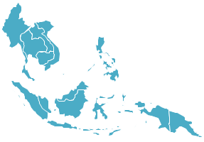
New Astergea wrote:Hello,I'd like to request a world map(?)(i think thats what its called?) in vector form that highlights in my flags blueish color South East Asia from
Myanmar
Thailand
Vietnam
Cambodia
Laos
Philippines
Malaysa
Indonesia
Singapore
Timor-Leste
Andaman and Nicobar Islands
Christmas Islands
Papa New Guinea
Solomon Islands
Fiji Islands
Vanuatu
New Caledonia
Something like this (Image) but with the globe thing as well as the respective other islands and places i mentioned above?
Thank you! I might request more maps in the future but currently just these few for the sake of my wip factbook !
by Antwhen » Tue Nov 01, 2016 2:49 pm
Almonaster Nuevo wrote:
What (if any) information from the RL underlay are you wanting to include?
What is the name of the central city? Are there others to be included?
What is the significance of the red and blue areas? Are there any subdivisions to show?
Do you want any of the surrounding areas labelled?
by Yatzatz » Sun Nov 13, 2016 10:48 am
by Almonaster Nuevo » Mon Nov 14, 2016 2:08 pm
Antwhen wrote:http://imgur.com/dHBYGNe
Can someone please make a really vivid political map of my nation? It's about where the shapes are on my rough draft, but it's all subject to change. I can talk to you more through telegrams if you need clarification or to work out the map. Thank you!
by Fahshist Yuflijan » Fri Nov 18, 2016 1:51 pm
Fahshist Yuflijan wrote:Hello, I was wonder if someone could make me a map.
I would like six islands each around the size of Scotland or England in the North West Pacific, near Kamchatka and Japan.
And I would like about half of Eurasia in the same colour as the islands, and this nation controls Eurasia up to the Urals, and the Dead Sea. I would like the colour of Yuflija territory in dark orange, like my flag.
The rest of Europe (including the British isles) and North Africa will be labeled Nazi Germany and in Nazi Red.
The USA controls all US territories at the time of WWII + Australia and South Africa.
If this is too much, my apologies.
by Almonaster Nuevo » Sat Nov 19, 2016 10:45 am
by Antwhen » Tue Nov 22, 2016 9:32 pm
Almonaster Nuevo wrote:Antwhen wrote:http://imgur.com/dHBYGNe
Can someone please make a really vivid political map of my nation? It's about where the shapes are on my rough draft, but it's all subject to change. I can talk to you more through telegrams if you need clarification or to work out the map. Thank you!
by Yatzatz » Thu Dec 22, 2016 4:23 am
Yatzatz wrote:My map is in my factbook. Can you make it look real? The triangle-shaped island in the north is all forest, the northeastern tip of the southeastern island is mountains, and the northeast island is extremely varied.
Advertisement
Return to Factbooks and National Information
Users browsing this forum: Valentine Z
Advertisement