

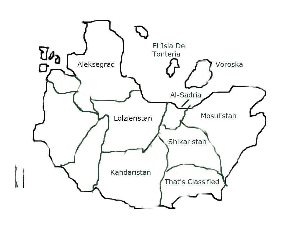
Representing 13 regions, over 345 nations, and billions of sq. miles of the earth, the Nationstates World RPing map is a project headed by United Gordonopia and aided by the cartographers of the participating regions and the frequenters to the NSsanctuary IRC channel.
The map itself, designed to give RPers a sense of their location in relation to their peers, currently contains twelve major RPing regions ranging from old survivors such as Greater Dienstad and Gholgoth to new startups such as Minyang and Adrastos. Encompassing a colossal 14,400,000,000 sq. km, and stretching 150,000 km East to West and 96,000 km North to South, this map gives users just a small sense of the massive scale of the NS World.
Currently, applications are being taken to fill the limited amount of space available on the map. Note that the vast majority of islands in between regions are there for aesthetic purposes and can be removed. However, to preserve space for notable RPing regions, any and all applications will be taken to NS Sanctuary where they will be discussed for notability. Because of this, the majority of applicants must understand that it is likely they will get denied. Applications are limited to regions only. For individual nations, please telegram United Gordonopia.
Application Form (All Fields Required):
- Code: Select all
Region Name:
URL of Region:
URL of Map:
Scale of Map:
Requested Location:
Brief Summary of Why This Region Should Be Included:
Landmass Only Version
Time Zone Version
We are currently on version 1.3


