NATION

PASSWORD

How To Make Decent Maps

A place to put national factbooks, embassy exchanges, and other information regarding the nations of the world. [In character]
User avatar
Motuka
Diplomat
 
Posts: 797
Founded: Jun 03, 2005
Ex-Nation

How To Make Decent Maps

Postby Motuka » Tue Jul 05, 2011 8:36 pm

Of late I have noticed a large number of threads along the lines of "please make me a map" or "how do you make good maps?". There also seems to be a general conviction that making maps is hard, and high praise is showered upon those who display competence in the field. This is wrong because making maps is, on its own, not a particularly difficult skill to master. With practice, you can produce some quite professional looking stuff, and with tutorials, you can at least manage something that doesn't look like a monkey made it in MS Paint and then compressed it into JPEG five or six times over.

The first thing you'll need is an image editor that can handle layers.

I'm going to be demonstrating this in GIMP just because (a) I have it (b) it's free (c) it works on most platforms. If you run Windows all this should work just as well on Paint.NET and if you have the cash to shell out for Photoshop or Illustrator or whatever... you lucky bastard. >.<

1: Start big.

The base version of your map should be large. Larger than it needs to be, even. You can shrink it down later if you want and it'll survive with minor adjustments. Trying to blow up a small map won't be nearly as effective.
Image

2: Work out a scale. It's not strictly necessary to do this first, since you can work it out later from the overall dimensions of your map, but it's always a good idea. This makes it easy to calculate distances (with the measuring tool or its equivalent in whatever software you're using) and is generally a helpful guide to how far apart cities, climatic zones, national waters, etc should extend. For a map of this size, I'm keeping things simple: 1 pixel per kilometer (a scale of about 1:2,834,628).
What it looks like now

3: Draw your borders. Even if you're the kind of person *coughpedantcough* who doesn't approve of any maps not drawn from the plate tectonics upwards, you're going to need at least a vague outline of what your country looks like in order to determine where exactly said plates are. Borders should be on a new layer, since you'll either want to duplicate them often or be able to select the inside of their area for colouring in. Draw at around 400-500% zoom, even if you're very sure of yourself; it's much harder to get details in at 100%, particularly for those unfortunate souls using trackpads or clit mice like myself.

This brings us to the first practical consideration. Realistic-looking borders. Geography is fractal: highly detailed at every level of zoom. Your borders should not be blocky or blobby -- not rounded, certainly not square. They should be jagged. Coastlines have bays, coves, capes, estuaries, peninsulas, and straits. Borders may follow mountains or rivers (although they may also be straight lines, typically when set by treaty); random curves and whatnot do not look particularly realistic. Let's say you're drawing an island country with an inland sea. It might look a bit like this:

Borders at 67% zoom

This also brings us to the first stylistic consideration: to antialias or not to antialias?

I used the paintbrush tool solely because it does antialias -- the lines look neater that way in my opinion. However, it's also inherently less accurate, due to the nature of antialiasing (it introduces additional pixels at varying opacities to smooth the lines), and some people prefer the non-antialiased look. Here's a side-by-side of my antialiased drawing with Non-Antialiased Island for comparison purposes.
Image

The next steps will focus on some common overlays. With layers, you can create a number of different maps (physical, political, urban areas, topographic, bathymetric, etc) covering the same area.

4: Rivers, Oceans & Lakes.

Colouring in oceans is easy (I'll deal with bathymetry in a separate section). Select the outside of the borders with the magic wand tool, create a new layer, select a suitable shade of blue and click anywhere inside the selected area with the paint bucket.
What this looks like

Rivers and lakes are slightly more time-consuming. First, invert your selection (ctrl-i in most programs) so that the area inside the borders -- empty on this layer -- is selected. Second, brandish your paintbrush or pencil tool and get to work. You can draw rivers in the same shade of blue as the oceans, or make them darker or lighter; some shade of blue, however, is customary.
What this looks like

There are a number of important things to remember about rivers. Typically, rivers start at high elevations and flow towards low elevations, according to gravity. As such, all the rivers on this map start inland, in areas where elevation is likely to be high, and flow to the sea. River basins may also be endorheic (i.e. with no outlet to the sea), typically in desert regions or other areas where the river flows below sea level. Freshwater rivers do not flow from one sea to another. The only "rivers" that do this (like New York's East River) are actually tidal straits. Likewise, although this may seem incredibly basic, rivers "rise" somewhere (water comes out of the ground) and have a "mouth" elsewhere (where the water flows into the sea/a lake/a delta/a salt pan/another river/etc). You will not see circular rivers or any such silliness.

Rivers often have tributaries -- smaller rivers that flow into them. I've shown a few. Distributaries, where a smaller river branches out from a large one, are much more rare -- I've only included one. The only time you'll see lots of distributaries is in river deltas, where the flow rate decreases dramatically and silt carried by the river forms natural dams that cause numerous bifurcations. If you make a map which has lots of rivers that split into smaller rivers flowing different directions, you should be aware that this is rather unrealistic -- particularly if it occurs at high elevations. Rivers follow the path of least resistance. That's path, singular.

Meandering or braided rivers are common in the lower reaches of any stream's course; I've shown a couple of examples of what these might look like on a map. Rivers may flow into a delta or an estuary instead of simply falling into the sea direct; there are examples of those, too. Rivers typically don't just stop in the middle of nowhere, but as mentioned this can happen in endorheic basins -- if your nation has a desert climate or highly karstic (limestone) terrain, rivers can drain to inland deltas or depressions, disappear into sinkholes or drain to isolated lakes whose only outlets are seepage and evaporation. Rivers also tend to have great erosive power, and will carve out valleys that are lower than the surrounding terrain.

As for lakes: they can be fed or drained by rivers, but that's not compulsory. Lakes with no inlets or outlets are quite possible, and lakes may really be of any size. The only hard and fast rule is that however many inlets a lake has, there will generally be only one (natural) outlet. Path of least resistance, as above.

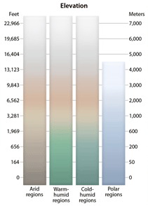
5: Topography & Bathymetry.

Topography is better known as "height on land"; bathymetry as "depth at sea". The most common way to express both is with bands of different colours. On land, one can include anywhere from three (green for low, yellow for mid and orange, red or white for high elevations) to dozens of colours. Here's an example from a website that makes maps professionally. I'm going to use six, a colourscheme I've seen a number of people use although I'm not completely sure who originated it -- Belkaland, perhaps? -- incidentally, anything you do steal should be credited <.<

Still have the interior of your borders selected? Good. Make a new layer, hit the paint bucket, use the shade of sea level green and colour in the whole thing. If this hides your borders, you can drag the layer with your borders on it up to the top of the layer stack. Also drag your new layer below the rivers/oceans/lakes one, so that water features are visible. This is important because you'll probably wind up drawing a fair bit of terrain around them.
What this looks like -- note layer stack organisation

This is likely the most time-consuming part of drawing maps: the contours. There aren't any good shortcuts I can think of for making these. Just select the next colour, switch to the pencil tool, and start drawing. It can be a good idea to sketch the outlines of mountain ranges, river valleys and depressions in a sketch layer if you want. (Note that at this point I opted to delete the ocean, since it was hiding the colours key -- I can always restore it later.) Also remember that the same principles that apply to coastlines apply to contour lines -- they're very uneven. Eventually, you should have something that looks a bit like this.
What this looks like. You can see what I meant by "drawing around water features".

Obviously, there are different ways -- all of them time-consuming, but some you may find preferable. Instead of different colours one can model terrain with the contour lines familiar to anyone who's looked at maps by the USGS/OS/Atlas & Gazetteer/your country's equivalent. This will take just as long and won't look as pretty, but there are advantages: it's easy to find the specific elevation of any one location, one can add colour overlays indicating tree cover or parkland or private property or whatever, and rivers can be easier to see (blue on green doesn't always come out well). Or one can simply skip the topo maps altogether and rely on terrain maps to get the message across. I'll cover that in a later section.

Ocean depths work the same way. Find a few colours (I'll use four) and draw continental shelves, trenches and whatever else takes your fancy. Just remember to invert your selection so you're colouring in the outside of the borders. :P
What this looks like. I've also copied the colours key down to the bottom for our legend, although I don't think you can see it in this screenshot.

6: Terrain & Land Use Maps

But topography, you might argue, is unnecessary. The precise elevations of everything in my nation, though they may add verisimilitude, are not that important to me. Moreover, it's a lot of wasted effort because it requires a lot of work and doesn't include lots of information I need to know: how much arable land there is, what natural resources my country has, where the deserts are....

If something like that was your first thought upon reading the section above, this may be the place for you. And if you survived topographic maps, land use and terrain maps are much easier to make. This is, however, an area much prone to abuse, largely due to simple ignorance. I've seen people plop down deserts right next to tropical rainforests. Obviously it's governed by the Rule of Cool to some degree, aka "But this is NS!" -- people think it's cool to have a desert, a jungle, glaciers and tundra all over the place, with volcanoes sprinkled wherever they're convenient.

It's best to do your research before starting. Determine your approximate latitude, and figure out how the ocean currents will affect your climate. I'm drawing an island country, and I'll decide to stick it just north of the Tropic of Cancer with prevailing currents from the southwest. The climate will be humid subtropical in the south and west, drier around the inland sea and more oceanic in the east. There'll be a desert in the south central region of the country due to the rain shadows from nearby mountain ranges.

The first step of a terrain map is to make your key. Create a new layer and add something to the legend looking a bit like this -- colours and symbols I'm selecting pretty randomly. One of them's stolen from a NS trophy; you could use those, or just existing geometrical brushes in different colours if you don't feel like defining new brushes as I did.
Image
Now, do what you did with topography: start filling in terrain, define some new brushes and plop down resources.

The coloured-in map raises another question, however: placement of cities. (Cities are surrounded by built-up areas, which are brown on this map.) I'll cover it in detail in the next section, but cities will come up in RP quite a lot and shouldn't simply be placed at random. Don't worry about them for the moment.

The symbols don't come out well at 67% zoom but here's what a portion of the map might look like at 100%:

Image

7: Cities

Cities should be a separate layer. You can make a wide variety of political maps involving them, and you won't necessarily want terrain or topography interfering.

If you're being realistic, however, cities don't come into being at random. They are born at crossroads, at river junctions, at natural harbors, at oases and at places rich in natural resources. They might come to occupy positions of strategic importance, or they might simply be the one place where the land is flat enough to farm and the river narrow enough to cross. Though a few cities will be purpose-built to serve as capitals, labour camps, or any number of other things, above all the locations of cities are determined by the nation's geography.

Switching back to my terrain view, I'll take a moment to identify a few likely sites where cities might come into being. Illustrating the process consciously looks something like this, although I'll obviously take many more considerations into account. Not excluding "parts of the map that would look good with more cities" either. <.< Cities are going to be much less common in deserts, icy tundra, rainforests, high mountains and other such extreme terrain; they'll cluster around river valleys and along coasts, and spread out through agricultural land.

Once I've finished adding cities, I find that lo and behold, they map perfectly onto the built-up areas I drew into my terrain map. What a strange coincidence. You probably won't be so lucky, so draw the rest of the terrain first, then the cities, then add the urban areas.

The cities are just dots -- the larger the dot, the larger the city -- due to laziness on my part. There are other solutions; here's a common one.

Now that you've got geography and cities, you have all the information necessary to draw up internal administrative divisions. Divisions are much like national borders: they will follow mountain ranges, rivers, and other features; and may also be straight lines arbitrarily set as such, or compromises between disputed territories. I don't feel like drawing any more right now though and I think you guys get the general idea by this point.

Questions, criticisms, anything I overlooked or was off base with, all welcome. If there's anything else you want me to demonstrate let me know.
Last edited by Dread Lady Nathicana on Tue Jul 05, 2011 10:51 pm, edited 2 times in total.
Reason: Profanity not necessary, thank you
World Assembly Personnel: Sandor Kaji ~ Julian Kbitaru

Political compass: Approximately -8 Social/+1 Economic (OOC); -6 Social/+9 Economic (IC) ~ Making Maps [suggestions welcome]

User avatar
Brique Island
Spokesperson
 
Posts: 195
Founded: Oct 05, 2009
Ex-Nation

Postby Brique Island » Tue Jul 05, 2011 8:45 pm

nice guidelines. :)
BRIQUE ISLAND FACTBOOK

A note to coffee snobs everywhere - Do we applaud fair-trade, sustainable farmed, shade-grown joe? Sure. Why not? But when we sit down to a cup of coffee in the morning, we are not particularly interested in the blueberry, caramel, or tomato soup nuances a dedicated roaster can coax out of a bean, nor in the intricate ballet of the four-minute pour-over or the Eva Solo flagon. We want coffee that tastes like coffee, and we want it now.

User avatar
Aleine
Bureaucrat
 
Posts: 44
Founded: Jul 03, 2011
Ex-Nation

Postby Aleine » Tue Jul 05, 2011 9:05 pm

While your map is pretty good, I'm still not convinced by the ocean palette and the amount of "jagginess" you used, sure, coastlines are jagged, but not THAT jagged, all the other aspects are really good, I'm also surprised how good it looks with only four colors for the land area, on my last map I used like 20 for the land and 10 for the sea.
Last edited by Aleine on Tue Jul 05, 2011 9:09 pm, edited 1 time in total.
The Stellar Republic of Aleine
Reach: 47 Stellar Systems
Denonym: Aleinitte
FutureTech
Stellar Republic of Aleine

User avatar
Motuka
Diplomat
 
Posts: 797
Founded: Jun 03, 2005
Ex-Nation

Postby Motuka » Tue Jul 05, 2011 9:22 pm

Aleine wrote:While your map is pretty good, I'm still not convinced by the ocean palette

Yeah I'd probably fuck with that more if I was making this as anything more than just an example.
and the amount of "jagginess" you used, sure, coastlines are jagged, but not THAT jagged,

Well... consider that at 1:2 800 000 this map is really quite low-resolution. A lot of detail is not included. The number one thing I skimped on was rivers, of which there will be lots (particularly in the wetter, forested areas). A lot of the little bays and coves -- at least, that look little on this map -- are going to be rias: drowned river valleys. Plenty more are just there, created through erosion or whatever. Some of them might need to be a bit more rounded, but real geography does look like that.

I do agree with you on some of the contours, though -- they're a bit too sharp -- particularly on the bathymetry. Thinking of redoing that.

Oh -- and people can feel free to offer any additional tips if they think I've missed something, or to expand on anything I've said.
World Assembly Personnel: Sandor Kaji ~ Julian Kbitaru

Political compass: Approximately -8 Social/+1 Economic (OOC); -6 Social/+9 Economic (IC) ~ Making Maps [suggestions welcome]

User avatar
Vortiaganica
Senator
 
Posts: 3880
Founded: Jun 14, 2008
Ex-Nation

Postby Vortiaganica » Tue Jul 05, 2011 9:30 pm

This is, I think, the first guide of its sort, or at least the best.

Certainly, sirrah, you have taken the art of NS cartography and given it a user-accessible manual.

I congratulate you.

But you must now translate it to Japanese, Chinese, Hindi and German, as all good manuals must.

Other than that, it's a great job. Should really be sticked. Regardless, you've covered a lot.

The only thing I can recommend is a glossary or index or something of ready-made symbols, in a neat picture, for the truly graphics incompetent.
The Grim Reaper in Disguise

User avatar
Red Tide2
Diplomat
 
Posts: 578
Founded: Jun 03, 2004
Ex-Nation

Postby Red Tide2 » Tue Jul 05, 2011 9:33 pm

Question: what the hell is fapium?
The Red Tidean Union or The Union of Red Tide or the RTU or Red Tide. NOT Red Tide2.
Red Tide is an oligarchy, with the ruling body known as the 'Central Institution'. The Director of the Central Institute changes constantly. It follows no political ideology, so stop mistaking it for a communist state, thank you very much.

Anemos Major, on my nations name wrote:Oh boy, I can imagine being invaded by your nation.
"The Red Tide washes over us once again. But why?"
"It's that time of the month again."
Thank you, I'll be here all week. Try the veal.

User avatar
Grays Harbor
Post Marshal
 
Posts: 18574
Founded: Antiquity
Inoffensive Centrist Democracy

Postby Grays Harbor » Tue Jul 05, 2011 9:35 pm

Vortiaganica wrote:The only thing I can recommend is a glossary or index or something of ready-made symbols, in a neat picture, for the truly graphics incompetent.

These are some of what we use on my regions maps
Image
Everything you know about me is wrong. Or a rumor. Something like that.

Not Ta'veren

User avatar
Calmerica
Diplomat
 
Posts: 814
Founded: Aug 31, 2010
Ex-Nation

Postby Calmerica » Tue Jul 05, 2011 9:37 pm

Aleine wrote:While your map is pretty good, I'm still not convinced by the ocean palette and the amount of "jagginess" you used, sure, coastlines are jagged, but not THAT jagged, all the other aspects are really good, I'm also surprised how good it looks with only four colors for the land area, on my last map I used like 20 for the land and 10 for the sea.

I agree.

Overall though, this is bad ass. Great guide for those that don't know anything about environment, geography, or for people who do and can't manage GIMP/ PS whatever. I have PS Elements and find it extremely hard to make realistic maps. You sir, are king.
Enadia ¦ Calmerica ¦ Enadia Discord
Economic Left/Right: 2.00 | Social Libertarian/Authoritarian: -2.50
Alternate History
Cartographers Guild
Selective Constitutionalism
CDAR: [5] 4 3 2 1
Libertas of Calmerica
Chancellor: Ivan Moldavi (2006)
Population: 23,310,340
Military: 835,000 (200,000 reserve)

User avatar
Orlkjestad
Negotiator
 
Posts: 5280
Founded: Aug 31, 2009
Ex-Nation

Postby Orlkjestad » Tue Jul 05, 2011 10:49 pm

Some coastlines are even curved. Case in point:

Image


Look closely at the map of the Los Angeles Metropolitan Area. Can you see the naked mermaid curved coastlines? Erosion can turn rocky coasts into smooth, curved beaches.
The Reformed Republican Union Of Orlkjestad
Comrade-President Leon Palantine
Vice President Arcturo Tarentum
Secretary Of Foreign Affaires Marco Valentia
Storefronts: They're all under construction, please go away
Alliances: Forever alone
Other Threads: The Severan Faith
Alert Levels
DEFCON: 1 2 3 4 [5]
Terrorism Alert Levels: [Low] Guarded Elevated High Severe

"Although we see the world through different eyes, we share the same idea of paradise." -The Pet Shop Boys in Se A Vida E

User avatar
Motuka
Diplomat
 
Posts: 797
Founded: Jun 03, 2005
Ex-Nation

Postby Motuka » Wed Jul 06, 2011 6:00 am

*flips Nathicana the bird* Edit this, motherfucker!

Vortiaganica wrote:The only thing I can recommend is a glossary or index or something of ready-made symbols, in a neat picture, for the truly graphics incompetent.

Ooh, good idea. I'll make some parts sheets in a bit.

Grays Harbor wrote:
Vortiaganica wrote:The only thing I can recommend is a glossary or index or something of ready-made symbols, in a neat picture, for the truly graphics incompetent.

These are some of what we use on my regions maps
Image

Hmm. This is obviously less Ordinance Survey and more Tourist Information, but certainly a good thought. If people were to use this who do they credit for it?

@ Orlkjestad -- you're absolutely right; at a higher zoom level many of the jagged edges in my example map would prove to be gentle curves.
Last edited by Motuka on Wed Jul 06, 2011 6:03 am, edited 3 times in total.
World Assembly Personnel: Sandor Kaji ~ Julian Kbitaru

Political compass: Approximately -8 Social/+1 Economic (OOC); -6 Social/+9 Economic (IC) ~ Making Maps [suggestions welcome]

User avatar
Grays Harbor
Post Marshal
 
Posts: 18574
Founded: Antiquity
Inoffensive Centrist Democracy

Postby Grays Harbor » Wed Jul 06, 2011 10:23 am

Motuka wrote:
Grays Harbor wrote:These are some of what we use on my regions maps
Image

Hmm. This is obviously less Ordinance Survey and more Tourist Information, but certainly a good thought. If people were to use this who do they credit for it?

Ineptia was the primary developer of the heartland guidelines, assisted by myself and PopularFreedom. They have served us well over the years since our first map was drawn in Jan 2003. Some folk have also added their own symbols as well, as can be seen on our map.
Everything you know about me is wrong. Or a rumor. Something like that.

Not Ta'veren

User avatar
Motuka
Diplomat
 
Posts: 797
Founded: Jun 03, 2005
Ex-Nation

Postby Motuka » Wed Jul 13, 2011 12:37 pm

As I've got access to a computer with Photoshop Elements (a basic low-end version of PS) and a repository of satellite images, I figure it's worth covering a really easy way to make hypsometry that looks realistic. Yep, that's right -- steal it from real life.

You will need the following:

(a) a heightmap,
(b) a small amount of imagination,
(c) the ability to make the rest of your map live up to the terrain.

A heightmap is in its simplest form just a grayscale image, which probably looks something like this. It's real-life terrain, so the oceans are already indicated in blue; you could probably find heightmaps in which they aren't, however.

To convert it into proper terrain, all you have to do is this.
Image
Image
Image
The result looks like this and takes about two seconds to make.

For (a) -- there's Google, various government agencies, and anywhere else you can pick up data. Check out this website, for instance. (b) comes into play mostly when trying to keep your map from looking too much like real life. (Who cares to guess what landmass I'm using in this image, and what transformations I put it through, if any? Cake for the first correct responder.) (c) is probably the hardest to do, since it's entirely subjective. Best bet may be to keep symbols etc simple and antialiased, so that they don't stand out too much as additions.

Incomplete parts sheet is on the other comp. That said, if anyone has anything they think should be added, let me know here/via TG/IRC/whatever
World Assembly Personnel: Sandor Kaji ~ Julian Kbitaru

Political compass: Approximately -8 Social/+1 Economic (OOC); -6 Social/+9 Economic (IC) ~ Making Maps [suggestions welcome]

User avatar
Greater Miami Shores
Postmaster-General
 
Posts: 10104
Founded: Aug 06, 2010
Capitalist Paradise

Postby Greater Miami Shores » Thu Jul 14, 2011 12:33 am

Interesting.
I once tried to K Me. Posted It and Reported. Locked by Mods. I am Autistic accounts for Repetitive Nature. I am Very Civil and Respectful to all on NS and off NS. My Opinions Are Not Bad Opinions No Ones Opinions Are Bad Opinons. We are on NS, to share, discuss, argue, disagree, on Trump, elections, Republicans, Democrats, Socialists, Libertarians and whatevers, with respect. This Respect Is Given It Is Not Earned, This Respect Is Called Freedom of Expression and Democracy. This Man Always Says What He Means, I Am The Real Thing. I Make Ted Cruz look like a Leftist. I have been on NS For over 10 Years with a Perfect Record of No Baiting, Trolling, Flaming, or Using Foul Language. I Am Very Proud of It and Wish To Keep My Record Clean. But I Am Not The Only One On NS. GMS. I'm Based.

User avatar
Kheil HaAvir
Attaché
 
Posts: 93
Founded: Oct 05, 2011
Ex-Nation

Postby Kheil HaAvir » Sun Dec 04, 2011 6:48 am

just to bookmark
"When I was a young man, I had liberty, but I did not see it. I had time, but I did not know it. And I had love, but I did not feel it. Many decades would pass before I understood the meaning of all three."
Ezio Auditore Da Firenze

User avatar
Mapletish
Minister
 
Posts: 2714
Founded: Feb 26, 2011
Civil Rights Lovefest

Postby Mapletish » Sun Dec 04, 2011 8:51 am

I notice that u are using Macintosh for this so anyway I can do it for Windows?
The Minuscule Nation Mapletish
Pop. 65,000,000 | Capital: Struggait City| Demonym: Maplish/Mapletian| Trigramme: MAP
First - WLC 24, DBC 43, XIV Winter Olympics Second - WCoH 22, RUWC 23, CR 24 Third- BoF 44, HWC 11, WCoH 20, WCoH 21, DBC 49 Fourth - U15WC9, RLWC12, CR 14
Qualified for WC 64, 66
www.unionsports.map
Proudly contributing my triumph's to the glorification of the greater whole!

User avatar
Rubinstern
Lobbyist
 
Posts: 12
Founded: Nov 10, 2011
Ex-Nation

Postby Rubinstern » Sun Dec 04, 2011 10:43 am

That is awesome but once you've made your map how do you get it on NS?

User avatar
Izzyshipper
Minister
 
Posts: 3009
Founded: Jun 12, 2010
Ex-Nation

Postby Izzyshipper » Sun Dec 04, 2011 10:46 am

Rubinstern wrote:That is awesome but once you've made your map how do you get it on NS?


Use Tinypic or Photobucket or some similar image hoster and upload it there. After you do, it should provide you with a URL to upload the image.

Also, I vote for thise awesomeness to be stickied somewhere.
Female |I use UK Spelling

Wise princes avoid as much as they can being in other men's power - Niccolò Machiavelli

Government- Monarchy
Ruler - Queen Sophia I
Demonym - Izzyerian

User avatar
Izzyshipper
Minister
 
Posts: 3009
Founded: Jun 12, 2010
Ex-Nation

Postby Izzyshipper » Sun Dec 04, 2011 10:51 am

Mapletish wrote:I notice that u are using Macintosh for this so anyway I can do it for Windows?


The same way, he's using GIMP which is a free software available to download.
Female |I use UK Spelling

Wise princes avoid as much as they can being in other men's power - Niccolò Machiavelli

Government- Monarchy
Ruler - Queen Sophia I
Demonym - Izzyerian

User avatar
Rubinstern
Lobbyist
 
Posts: 12
Founded: Nov 10, 2011
Ex-Nation

Postby Rubinstern » Sun Dec 04, 2011 1:38 pm

Aleine wrote: coastlines are jagged, but not THAT jagged

They might have had a natural disaster!!

User avatar
Syleru
Minister
 
Posts: 2807
Founded: Aug 11, 2011
Ex-Nation

How To Make Decent Maps

Postby Syleru » Sat Dec 10, 2011 1:08 pm

Thanks! This helps for my factbook I'm currently working on.
Syleruian Settlements
Environmental Policies
Security Policies
Military Policies

1 एn = $1.4
Tarvelia wrote:Environazis.

The only policies in my nation that I agree with are it's religious freedom and environmental sanctity policies. Do not think that I'm an anti-LGBT, dystopian repressive isolationist fascist and what have you mastermind trying to mask a greater goal under hordes of advertisements, propaganda and policing.
In short, my nation is a highly policed strict, seemingly utopian autocracy with an almost religious environmental fetish.
★ PROUD MEMBER OF THE ANTI-COMMUNISM ALLIACE
Syleruian Information Links / Syleruian Carbon Output Index (Closed for now)

Expect me to edit my posts 3-4 times after I post them, I'm picky like that.

User avatar
Arkotania
Minister
 
Posts: 2724
Founded: Sep 18, 2011
Ex-Nation

Postby Arkotania » Sat Dec 10, 2011 1:14 pm

tagged/saved/bookmarked/favorited or whatever the hell you wish to call it.
Mostly back from a long hiatus from the forums
Arkania 5 wrote:
Arkotania wrote:Matt Ward


No.

Nononononononononono

Gauthier wrote:
Arkotania wrote:
Then your testicles become strange tentacles.


And then you make films in Japan.

Ovisterra wrote:
Oceanic people wrote:where lives are at steak


I try not to point out people's spelling errors all the time, but this one was brilliant.


Nationstatelandsville wrote:
Arkotania wrote:Or maybe NS is also a degraded society.

This. Definitely this.

Neo Arcad wrote:
Qatarab(Arkotania Puppet) wrote:Where's my torch? Time to burn some courts down.


Oh, you crazy Muslim you!

User avatar
Dukopolious
Minister
 
Posts: 2589
Founded: Jun 17, 2011
Ex-Nation

Postby Dukopolious » Sun Feb 05, 2012 6:21 am

Excellent guide, some parts were a bit harder to understand, but if you were to do a video that would be solved (Suggestion?)

I often use Sumo Paint, it's free, it works like professional software, no downloading required, it's very easy and it's good for images all around.

I'm going to try and make a map soon, if it turns out good, is it okay if I post it here?
Mallorea and Riva should resign

User avatar
Ko-oren
Negotiator
 
Posts: 6775
Founded: Nov 26, 2010
Corrupt Dictatorship

Postby Ko-oren » Sun Feb 05, 2012 6:43 am

I use AutoREALM to make my maps, which has almost anything and it's quite intuitive.
WCC and WCOH President and NS Sports' only WC, WBC, WB, WCOH, IBC, RUWC, Test Cricket, ODI, and T20 loser!

Trigramme: KOR - Demonym: Ko-orenite - Population: 27.270.096
Map - Regions - Spreadsheets - Domestic Sports Newswires - Factbooks
Champions 1x World Cup - 1x CoH - 1x AOCAF - 1x WBC - 4x World Bowl - 1x IBC - 4x RUWC - 3x RLWC - 2x T20 WC - 1x AODICC - 2x ARWC - 1x FHWC - 1x HWC - 1x Beach Cup
Runners-up 1x World Cup - 3x CAFA - 1x AOCAF - 1x WBC - 3x World Bowl - 1x WCoH - 4x IBC - 2x RUWC - 1x GCF Test Cricket - 1x ODI WT - 2x T20 WC - 1x FraterniT20 - 1x WLC - 1x FHWC
Organisation & Hosting 2x WCC President - 1x WCOH President / 1x BoF - 1x CAFA - 1x World Bowl - 1x WCOH - 2x RUWC - 1x ODI WT - 1x T20 WC - 1x FraterniT20 - 1x ARWC - 1x FHWC - (defunct) IRLCC, BCCC, Champions Bowl

User avatar
An Slanaitheoir
Diplomat
 
Posts: 828
Founded: Feb 01, 2012
Ex-Nation

Postby An Slanaitheoir » Thu Feb 09, 2012 11:03 am

the pictures don't work.
"I am Patrick, a sinner, most uncultivated and least of all the faithful and despised in the eyes of many." ― St.Patrick

6% Cosmopolitan
43% Fundamentalist
5% Reactionary
8% Anarchistic
2% Communistic
14% Pacifist
4% Anthropocentric
My Political test results
My Political test results 2


If you care, the pronuciation is "an slawnihore"


Advertisement

Remove ads

Return to Factbooks and National Information

Who is online

Users browsing this forum: Ammmericaaaa

Advertisement

Remove ads