I am looking for someone with any artistic ability and a decent program for mapmaking. Sorry if there is already a thread for this, but I haven't seen it. Okay so here goes the request (if anyone is up for the challenge.
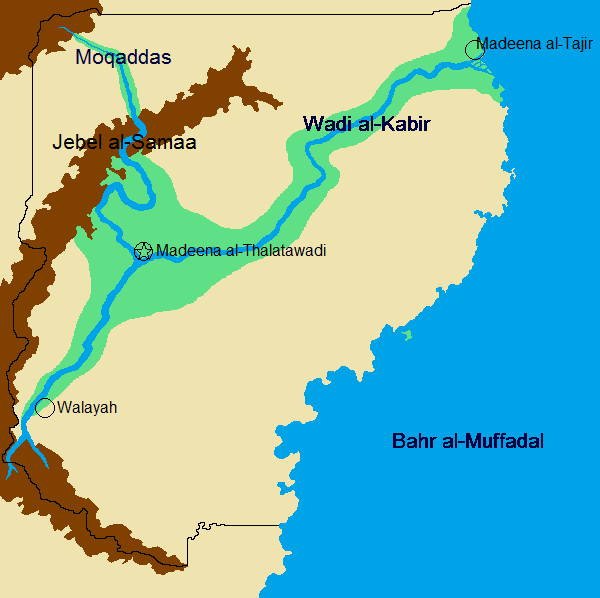
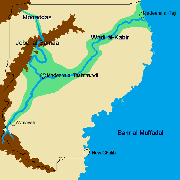
Sea (labeled Bahr al-Muffadal) to the East and land to the North, South, and West. Shaped kinda like Indiana, except with the would-be border of Illinois where the would-be border of Ohio is (if you understand that) and less squared off. One river labeled Wadi al-Kabir coming from the northeast coast of the Bahr al-Muffadal and another named Moqaddas coming from the northwest; this river should weave in between a mountain range labeled Jebel al-Samaa. Anyways, the Wadi al-Kabir moves inward and the Moqaddas ends when it feeds into it. Where these rivers connect, the capitol, Madeena al-Thalatawadi. At the beginning of the Wadi al-Kabir on the coast, a city named Madeena al-Tajir. To the far south on the Wadi al-Kabir, is a city named Walayah.
Please and thanks if you can take it on.
P.S. be creative with it and try to make it look professional.